Hike coordinator: Edwin Case
Narration by Lane Harris
If you look at a map you’ll see that Rattlesnake Mountain, Mosquito Lake and Windy Gap are all within a mile of each other. It sure doesn’t sound like a very friendly place to visit. Despite the threatening names given to these various land features, this area in the Rogue-Umpqua Divide Wilderness offers some of the most stunning scenery in our neck of the woods. Perhaps the names were a way to keep hoards of people away from enjoying the beauty of this area. What they should really worry about is the drive to get to the trailhead to Rattlesnake Mountain!
Edwin managed to attract a baker’s dozen for his steep trek to the top of rattlesnake Mountain. But first, he had to get them there…
The route to get to the trailhead in Fish Creek Valley south of the mountain consists, in part, of several miles along a dusty, pothole-filled road. With thick vegetation reaching out to scrape the sides of vehicles, its not the most vehicle-friendly road I’ve been on. However, there are worse roads out there, and at least this one didn’t require 4-wheel drive on this warm July day.
Arriving at the trailhead, hikers laced up their boots and began the march towards the mountain. The first mile was a steady climb along what is really Castle Creek Trail that unsurprisingly originates at Castle Creek. Taking a right at the junction, the trail climbs up to the intersection at Windy Gap. None of us detected any wind here, although we wish there was, as it was starting to get warm. We continued up the Rattlesnake Mountain Trail, and this is where the “difficult” part of the hike really begins to kick in. The trail sidewinds it’s way along the southern side of the mountain, with a fair number of steep parts that make you rethink this hobby called hiking. The saving grace were all the wildflowers that adorned the steep hillsides, along with the many meadows, giving hikers with cameras excuses to stop and take pictures while they catch their breath.
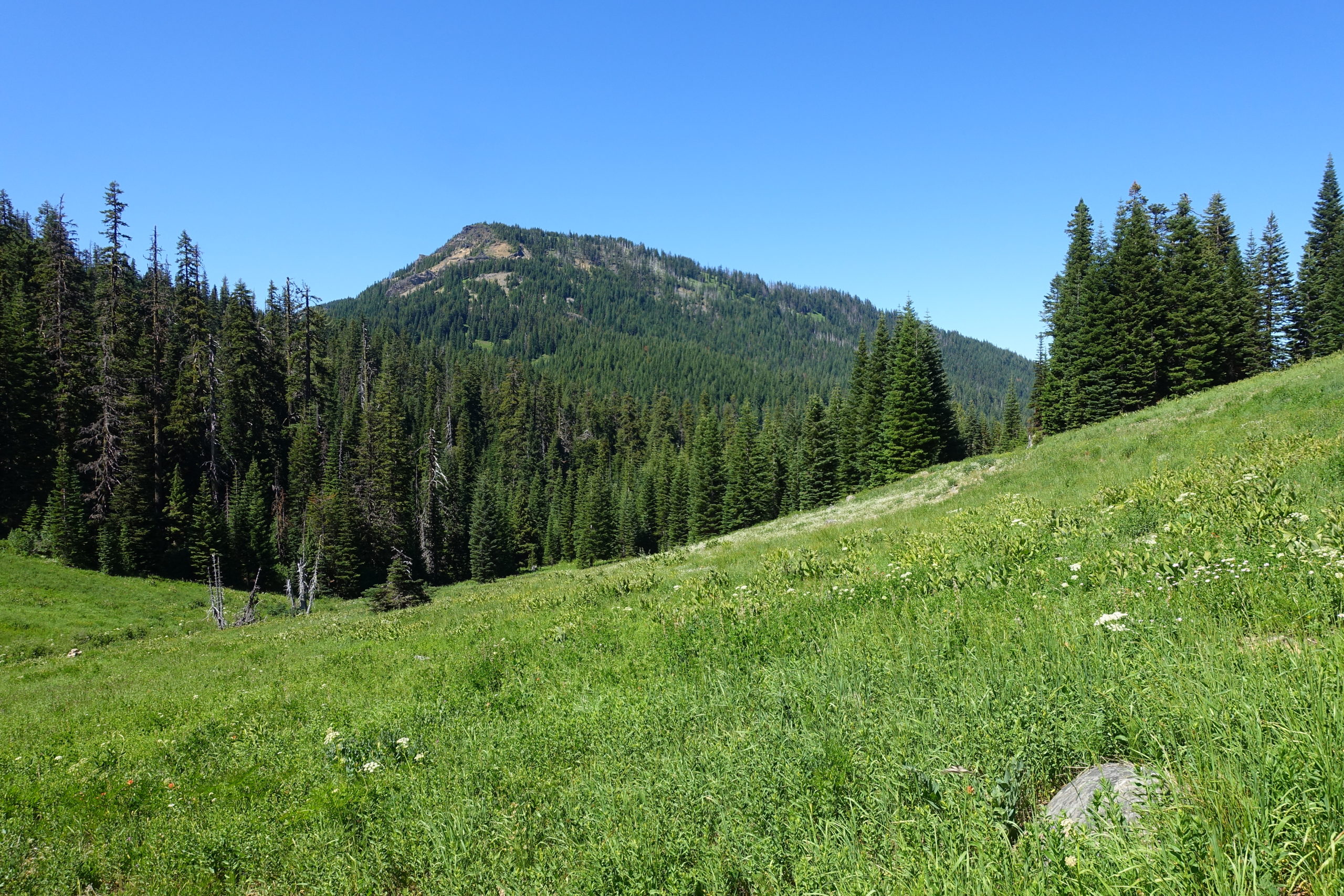
Eventually, and certainly not soon enough, the path took a westerly turn and took a much more gradual approach towards the top, taking us hikers through one of the largest meadows we would encounter this day.
This large meadow near the top afforded us southerly views as we languished in the casual stroll toward the western edge of Rattlesnake Mountain. Eventually, the trail more or less disappears, as adventurous hikers are likely to explore every which way up here. But our destination was the rocky overlook on the western side.
Upon arrival, most of us immediately divested our backpacks and just plopped ourselves on the ground, while others strategically claimed rocky surfaces near the edge of the cliff. Although the views here are limited to mostly to the west and south, they were nonetheless views.
After finishing our mountaintop lunch, the group gathered up and we did some exploring near the northern tree-covered side of the mountain. There, we discovered what was once, to the best of our knowledge, remains of an old lookout. Giant cement blocks indicated that the structure that once stood here was substantial. Some wisecrack comments were made about the poor souls who had to pack these huge cement blocks up the hillside. Obviously, that’s not true, as the likely mode of transportation for these behemoths would have been done by helicopter.
After the history show, we looked forward to making the trek down, this time appreciating the meadows without the heavy breathing like we did on the way up. It was getting warmer by the minute as we hiked down, but at least it was down! We took a left at the Windy Gap intersection, which took us onto new trail. At one point, the trail crosses a small creek, giving hikers two options to traverse it: A log that stretched across to the other side, or the mundane lower path where hikers could just hop across the creek. With the exception a few hikers, everyone else chose the somewhat challenging, but mostly safe log option. Fortunately, no one ended up in the creek below and we applauded each other for this acrobatic accomplishment.
The remainder of the hike took us through mostly wooded hillsides, eventually culminating in tranquil meadows until we reached the road which was just yards from the trailhead. At this last meadow, we were able to turn around and peer up at Rattlesnake Mountain in awe as we speculated about how we actually hiked up that high. With a 1,500 ft elevation gain, this hike earns a well-deserved rating of “difficult”, but the beauty of the meadows and the overall views made the effort we put into it all worth it.
More pictures on Lane Harris’ Flickr page
Pictures below by Lane Harris


Beautiful pictures> I wish my wife & I could have been there. In a few weeks we will be at PCT days in Cascade Locks on August 19 & 20. Then we plan on hiking the 40 mile Timberline Trail around Mt. Hood hopefully. If we do we will post some Video on our Youtube page at Kim and Jeff aka Frick and Frack.
Thanks Jeff! Sounds like you guys are having a blast on the PCT. Timberline Trail too?.. You guys are animals! We wish you good luck and lots of fun, looking forward to having you hike with us again so we can hear about your adventures! 😀 🥾🥾🌲⛺
With all the latest forest fires in Northern California, (McKinney fire), the 3 fires in our area (Windigo Fire, Forebay 1 fire, & Fire 237) who knows what ithe weather will be like towards the end of August. We may not be able to hike around Mt. Hood. Only time will tell.