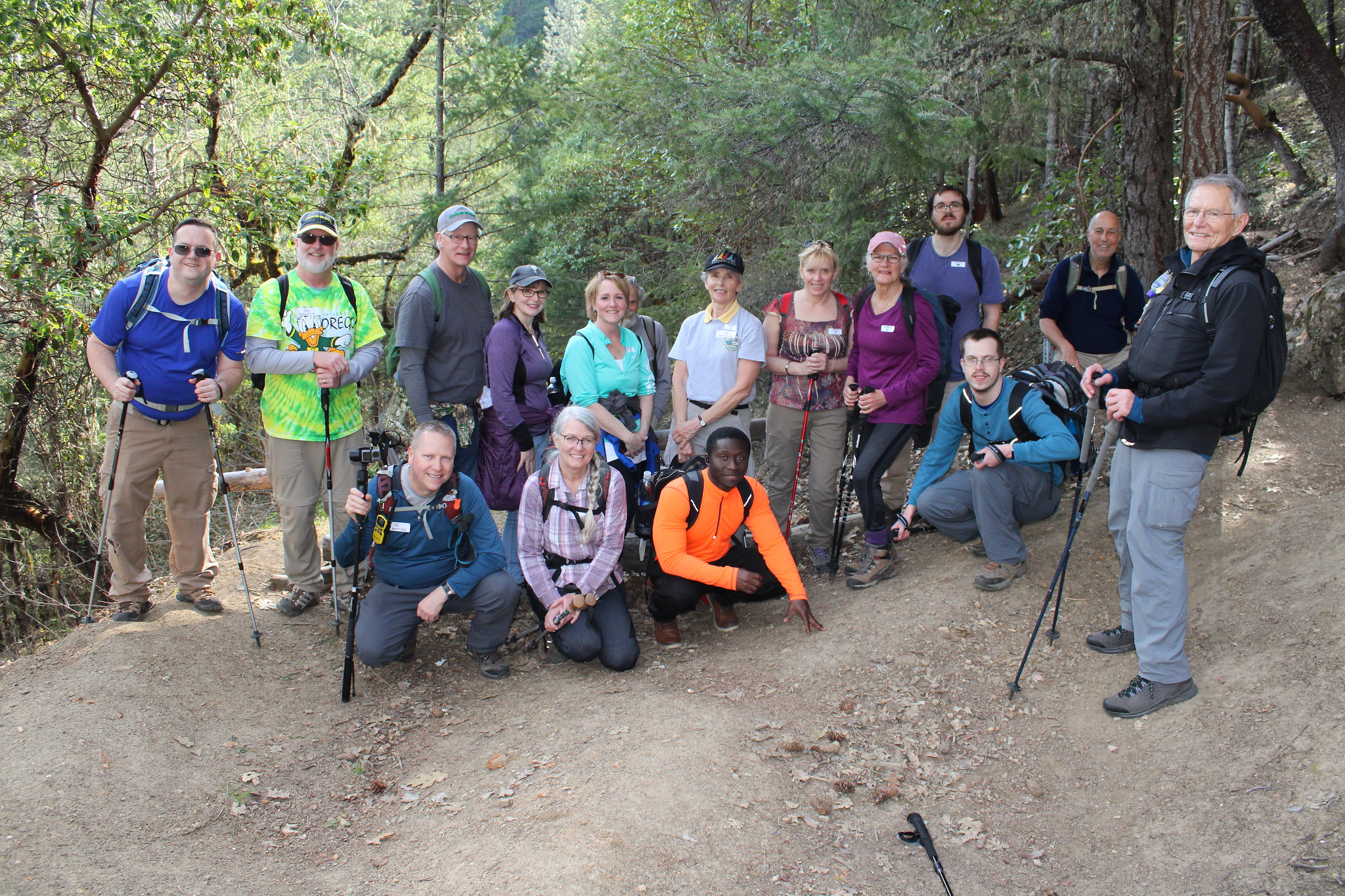
Jacksonville Forest Park – February 19, 2022

Hike coordinator: Lane Harris

Narration by Lane Harris

In the 1850’s Jacksonville was a thriving gold rush town, and the nearby hillsides were pockmarked with mines. Today, some of those mines are still accessible, but only to those who lay their hiking boots onto the steep trails in Forest Park just outside of town. Although the mines are now blocked with metal gates, one can still peer into the darkness and imagine what it must have felt like to explore these dusky caves that held precious metals.

The trails here can baffle the most educated trail master, and without a trail map you will be dazed and confused by the decisions you must make as to what trails to take. I was struggling to come up a hike to lead at the previous club meeting. I’m now certain that when Richard suggested this one for me, that he was pulling a cruel joke on me. Or, at the very least, testing my navigation skills. So, it was with due diligence that we scheduled a pre-hike with Medford hiking pal Glenn, who knew the trails well. I was feeling a tad under the weather the day of the pre-hike, so Richard and Glenn went by themselves. They were kind enough to take meticulous notes, and I used those notes extensively when I eventually pre hiked the trails myself a week before the scheduled club hike.

You can read Richard’s blog of the pre-hike here: Richard Hikes: Jacksonville Forest Park

On a chilly but clear blue-sky morning, we had no less than 16 hikers gather up at the starting point. I then proceeded to form three hiking teams. The faster hikers, Team Eagle, would follow Glenn. I would lead the monkeys in the middle, aptly named Team Monkey. And Richard would be in the rear leading Team Turtle. After ceremoniously handing out team name labels for everyone to adorn their chests with, we set out on our adventure.

Our route began along Jackson Creek. As we headed up along the creek, it soon became apparent to those who had not been here before as to why they were playing follow-the-leader: Within the first mile there are no less than eight trail intersections that would befuddle the uninitiated. Although detailed trail maps are available and the trail is well signed, its way too easy for new hikers to hesitate at each and every intersection and wonder which route to take. And this is why we pre-hike, boys and girls.

As Glenn, whose radio callsign was Eagle Eye, led his eagles swiftly up the path, trail sweeper Missy, aka Eagle Claw, ensured no little eaglets strayed off course. Except for the time Shannon left her hiking poles back at a bridge, no other oopsies would take place the remainder of the hike.

With my callsign of Monkey See, I entrusted Monkey Do, otherwise known as Rheo, to see that none of the monkeys monkeyed around and got lost. Sadly, I had only brought one banana for myself, leaving the rest of my troop to forage for their own food.

The much smaller group of Team Turtle, led by Turtle Head, consisted of only Richard, Chuck and Michael. It was determined before the hike that the trail sweeper role, which would’ve been Turtle Back, was not required for the small team. Going at a slower pace, Richard does what Richard does, which is photography. Looking back now, his callsign should’ve been Snapping Turtle.

And to no one’s surprise, this hike would be filled with a multitude of animal puns, jokes, and jabs. Yep, we were really behaving like animals by the time we were done.

We transitioned from following Jackson Creek to hiking alongside Norling Creek. Heading up, we took the Shade Creek Trail and eventually connected with the Atsahu Trail. All teams met at our first rendezvous point, the Norling Mine. From here, it was easy walking down what was really an old road. A few more trail junctions and we were at Twin Peaks Saddle. From here, the trail up to Upper Twin Peak is only 1/3 of a mile, but deceptively steep. Team Eagle, in usual fashion, was at the top in no time at all, while Teams Monkey and Turtle slowly trudged their way up the sheer path, stopping to catch a breath every few hundred feet or so.

A well-deserved lunch break was in order at the top, with hikers from each team catching glimpses of Mount McLaughlin off to the east, rising above the valley floor. With all the eagles, monkeys and turtles gathered in one spot, it was like attending a triple-header rock concert. (See what I did there?)

After the animals were fed, it was time to herd them downhill. The trail heading down took us past El Patron Madrone, an impressively huge madrone tree, and then through Mountain Mahogany Meadow. We hit the Owl Hoot, Boulder, and Ol’ Miners’ trails before arriving at the Handsome Mine. Here, everyone got to peek into the dark mine and get some photos with themselves next to, of course, the Handsome Mine sign. After posing for a group photo, the teams continued down the trail, eventually coming out at the road which we drove in on. A short walk along Jackson Creek again brought us back to our starting point.

All in all, this turned out to be a lighthearted hike, and everyone enjoyed the animal-themed event. I’m a believer that Team Monkey had fun, Team Eagle lived life in the fast lane, and Team Turtle was happy together.

Disclaimer: Although reactions to my bad puns during the hike may have hurt me, no animals were harmed in the making of this hike.

More pictures on Richard O’Neill’s Flickr page

Read more about this hike on Richard O’Neill’s blog, Richard Hikes

Pictures below by Richard O’Neill

Sunset Bay and Cape Arago – February 5, 2022

Hike coordinator: Cleve Moss

Narration by Cleve Moss

This was my first attempt to lead a hike. I had been challenged to lead a hike, as I attend many of the hikes and look forward to them. I had hiked from Sunset Bay to Shore Acres many, many years ago and have wanted to go back again, but had not. And so, I thought if I choose this hike then this would get it off my bucket list. 

Thanks to Richard O’Neill for offering information about the trail condition. He had contacted a friend from the Southcoast Striders club, who reported trail closure on the portion of the trail that went by the WWll Bunkers due to trees across the trail. But the lower leg going out to Cape Arago was open.

We left Roseburg with 14 hikers, and 4 others said they would join us at Sunset Bay. The Southcoast Striders asked if they could join us and showed up with 13, making a group of 31 eager souls wanting to see the beautiful foamy, jagged coast line, along with what could be seen on the horizon.

As with any hike on the coast during the winter, the weather is always of concern. As it turned out, it was a wonderful sunny day, with a little breeze. A heavy shirt or light jacket day.

I was trying to figure out how I was going to lead this hike, as there were many who knew the trail better than I, so I pointed at the trail head and gave the instructions to take your time, plan on eating lunch at Cape Arago and “Have Fun.” And away they went. I ended up not leading the hike, but was the last one, with everyone ahead of me. I was not too concerned, for how could you get lost on this hike? Too far in either direction and you either run into the road or fall into the ocean.

As we climbed up to the view points over looking Sunset Bay, the large group of hikers had spread out into several smaller groups. Some groups moved right along while others took their time drinking it all in. The tide was low and going out, making everything seem calm. On the horizon there was a large ship that seemed to be anchored, perhaps waiting for particular conditions before crossing the bar into Coos Bay. There were a couple of small fishing boats out on the water. Cape Arago Light House shined in the sun. Those that like to take pictures had many opportunities, always trying to capture the moment.

The trail skirted around cliffside edges, overlooking the rocks and ocean below. It took us to Shore Acres, and then down past Simpson Beach and to Seal Lion View Point where elephant seals could be seen and heard. Many strained the horizon to see a whale spout, but none could be seen today. We crossed the road and followed the trail that would take us to Cape Arago. When we arrived at the picnic area, the faster hikers were already sitting around tables, enjoying each other’s company, the view, and the nice warm sun, all while having lunch.

On the return trip it was noticeable that the tide had changed and was headed in. Waves were now starting to crash, throwing foamy water into the air. That is what we like to see along the rugged Oregon Coast. That is what makes this hike a favorite for many: White, foamy waves crashing into the air, seals and sea lions, sea gulls floating in the air, the possibility of seeing a whale, ships on the ocean. To be enjoying the outdoors, breathing and relishing the scenery with friends, some of them new, and some we had not seen for a while. It was a good day to be on the coast, and everyone most certainly had “Fun.”

More pictures on Richard O’Neill’s Fickr page and Lane Harris’ Flickr page

Read more about this hike on Richard O’Neill’s blog, Richard Hikes

Pictures below by Richard O’Neill

Scroll Up