Hike Coordinator: Lane Harris
Narration by Lane Harris
At our last hike planning meeting, I chose Cooper Creek for this date because I always think of February as the wild-card month when it comes to weather (Can you say Snowmageddon?) It’s best to choose those hikes that are at lower elevations, and if possible, close to home. Surprisingly, the weather was not all that bad on the day of the hike. A bit chilly in the morning, but dry for the hike. Perfect hiking weather, in my opinion.
As the vehicle count kept swelling at our regular meeting spot, I was thankful that the parking lot at Cooper Creek was as big as it was! We made the short drive to Cooper Creek and we were soon happily walking down the trail. It’s funny how a large group of people can suddenly appear small, or even disappear, within 3 minutes of a hike. Or maybe it’s just because everyone took off before I could finish filling out my $4 parking slip at the parking lot.
The Sutherlin Rotary Club, which built the trail, does a great job maintaining it. Us hikers are grateful to them for providing another trail for us to place our boots on. It will most likely become a favorite back-up place to hike if our club has to make last-minute changes in venues due to poor road conditions elsewhere, etc. But it does just fine as a planned destination, as was the case for today’s hike.
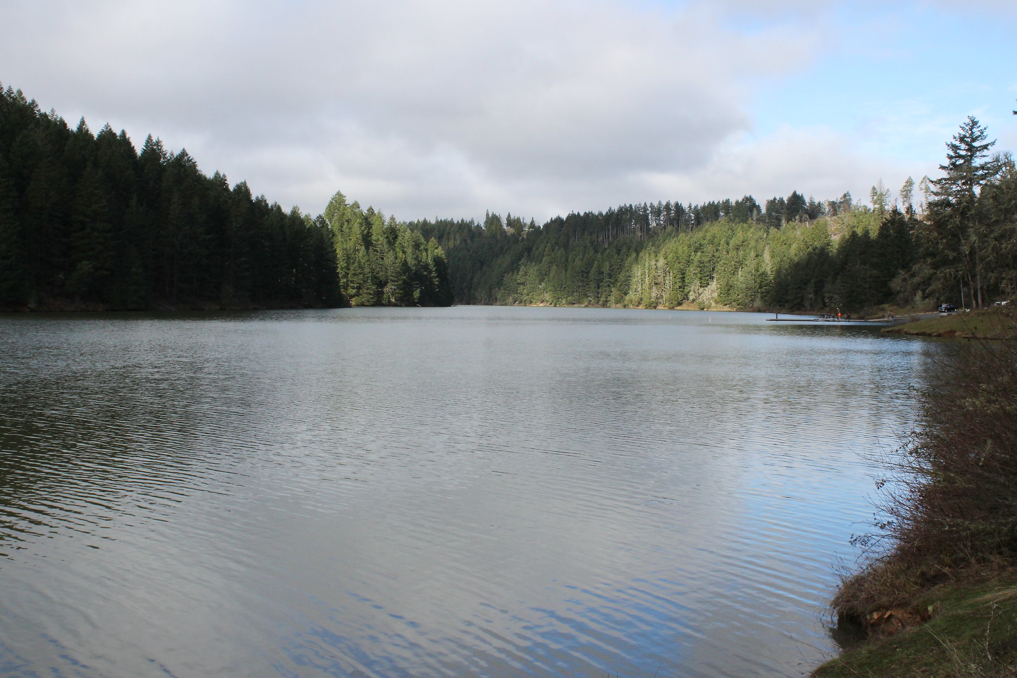
The plan for today was to hike counter-clockwise to the boat ramp on the Northeast end of the reservoir and then back, about an eight-mile hike. I offered two options to those who wanted a shorter hike, including continuing past the boat ramp for a two-mile road walk back to the parking lot, or if they wanted to, just wait at the boat ramp for a ride back to their vehicle. Little did I know that there would be an unknown third option waiting for us…
With approximately 15 hikers splintering off into smaller groups, it wasn’t long before the gang that I was in could see the group of speedsters already weaving their way to the boat ramp on the opposite shoreline. They appeared deceptively close, but I knew based on our location that we were a good 20 minutes or so behind them. We still had to wind our way around the eastern end of the reservoir before we were strolling along the same green path that they were currently on.
On the north shoreline there is picnic table sitting in an idyllic spot that makes for a great lunch spot. When we arrived there, I was a bit surprised that the group of quick hares hadn’t waited there for us slow tortoises. From this spot, you can also see the boat ramp, about a quarter mile or so up the trail. There are also bathrooms there. That must be where all the fast hikers went, I was thinking. A place which I must visit myself after a quick bite here at the picnic table. From this vantage point, I could also see what looked like a freshly cut path just on the other side of the boat ramp. Funny, I don’t remember that being there last year when we hiked here. It’s probably just a short path to the water’s edge for people to fish from, I thought, as I couldn’t see where it went.
The group of about eight of us sat and had a delightful visit eating our sandwiches and meat sticks. After that, some of us decided to make the short walk to the bathrooms. Upon arrival, I opted to ignore the call of nature, as I was immediately wondering where the group of sprinters ran off to, as they were nowhere in sight. They certainly did not turn around and go back the way they came, as we surely would’ve saw them. My mind instantly remembered that new path I saw on the other side of the boat ramp. I quickly darted across the road to check it out. Sure enough, a newly cut path continued westward towards parts unknown. Hikers are drawn to fresh, new dirt paths like flies are to honey. This MUST be where they headed off to: The unknown third option! After a quick confirmation with some boaters that the trail was put in just a month or so ago, I beelined it back to the picnic table to inform my group of slowpokes that the lightning crew had forayed down trails anew.
Again, I left the picnic table, this time making that long-delayed stop at the bathroom. Ok, I was good to go now. Our group was now ready to venture into the unknown! Pardon the excessive enthusiasm, but it’s not often that we hikers get to step foot on new trails, so it really is a treat when we get to.
Ahh, what a great day for a hike! The sun had come out, the birds were chirping, and we had not a care in the world. With an extra pep in our step, we joyfully strode upon this freshly blazed trail, while visions of a relaxing 2-mile stroll along the shoreline to the parking lot danced in our heads.
About a mile in, those visions abruptly ended. One of our members, who was ahead of us, was heading back towards us. Uh oh, this can’t be good. She said the trail kind of “peters out” up ahead. Decision time: Do we continue and see if we can pick up the trail, or head uphill and catch the road back? A few hikers had heavy packs on, they were training for the PTC, and they should probably go the safe route and hit the road. That was the decision made, and all those who were wise did the rational thing and headed uphill about 50 yards to the road and took the easy and safe way back. It was clear that continuing down the sketchy trail would be a task only fools would partake in.
As myself, Richard and Michael continued down the sketchy trail, we bid adieu to our coherent and rational fellow hikers. Nah, who needs them! They were just gonna get in the way of our untethered bushwhacking adventure anyway. Good riddance! Besides, we had Michael’s 2 dogs with us if things got desperate and we ended up in a survival situation… Ok, I’ll just let that one sit there for a bit…
We saw a few areas where the trail petered out (or peters out, I’m unsure now which one is correct). But we were able to follow ribbons which appeared to be where the trail was probably going to be properly constructed someday. In the meantime, we followed what seemed to be old game trails, and even human trails, likely created over the years as unofficial trails to access the shoreline. Overall, the last mile wasn’t all that bad, except for when it was. And no, we were never in any danger of getting lost, as we were wedged between the reservoir and the main road that parallels it the entire time. Admittedly, that did take the fun and excitement out of the whole thing.
We eventually rounded the final point of land and lay eyes on the parking lot across the way. Just one final loop around some watery obstacles and we were soon on the road leading to the parking lot. In turned out that our fellow level-headed hikers who chose not to participate in our bushwhacking journey were only a few minutes ahead of us. Oh well, their loss.
In retrospect, Richard stated he probably wouldn’t hike that last part again until they have completed the actual proper trail. I guess I would agree, but I did, and always will, enjoy journeying into unknown areas that we haven’t been to yet. Oh, and also, I’m glad that we weren’t put into a survival situation with Michael’s dogs… Ok, I’ll just let that one sit there for a bit again…
Read more on Richard O’Neill’s Blog
More pictures on Lane Harris’ Flickr page and Richard O’Neill’s Flickr page
Pictures below by Lane Harris and Richard O’Neill


I had a similar experience on the 7th! I followed down the new north side trail, but ditched out not far after the construction parts have ended, opting to climb up the forest hillside to the road. Wrong shoes! I can’t wait for the north side to be completed, and then we’ll have a great loop! I’m hoping to join LUMBR to help construct too. Take care, and good hiking!