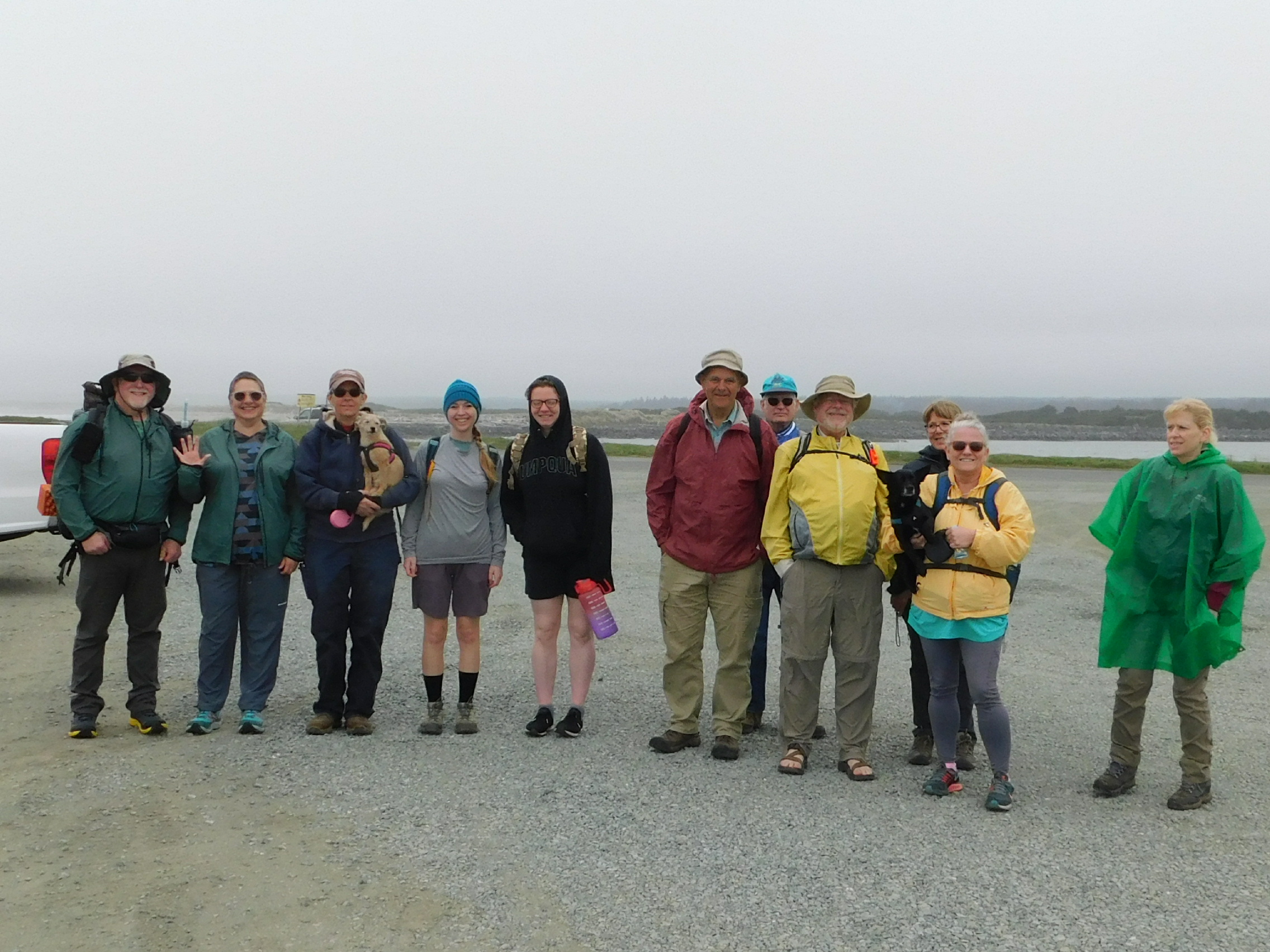
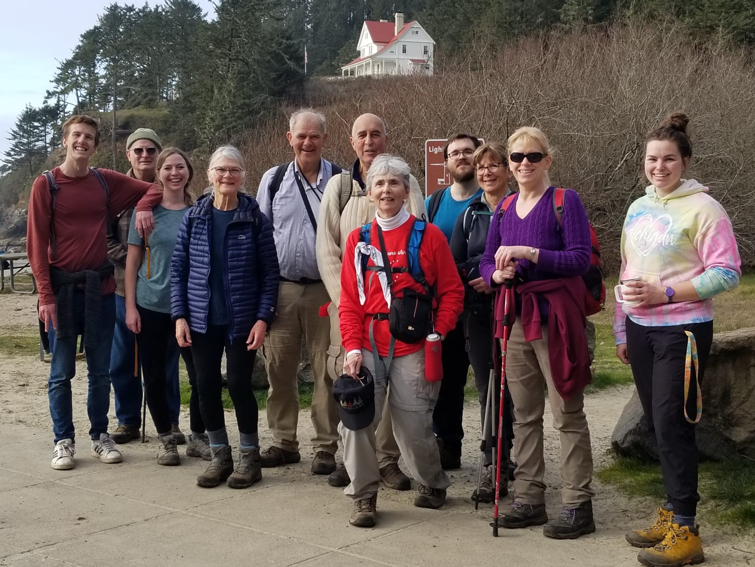
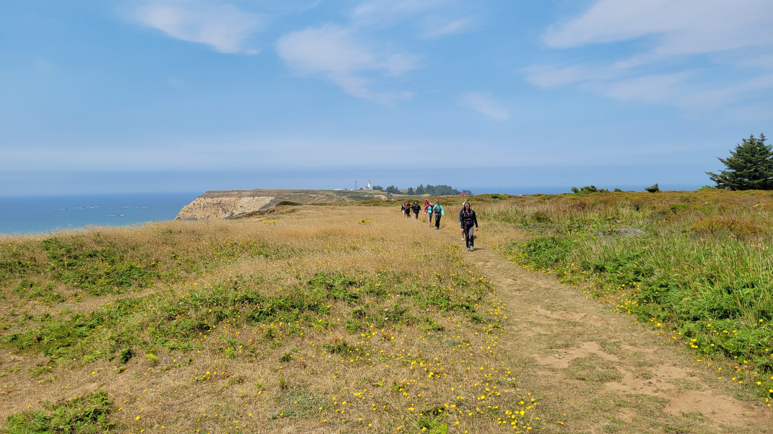
Floras Lake and Blacklock Point – January 7, 2023

Hike Coordinator: Lane Harris

Narration by Lane Harris

Blacklock Point is one of the most beautiful spots on the Oregon coast, and hardly anyone knows about it. This rugged headland, just north of Cape Blanco, is one of the wildest spots on the coast. Although traffic on Hwy 101 whizzes by just a few miles away, few travelers make the effort to find this lesser-known gem on Oregon’s south coast.

As the 14 of us gathered near the boat ramp at Boice-Cope Park near Floras Lake, the weather looked much better than anticipated, and thankfully it was dry for most of the hike, with only a few small sprinkles coming down a handful of times. Starting from the shores of Floras Lake, we headed south along the Oregon Coast Trail, winding our way through thick forests until reaching the main trail.

My intent was to make a few off-trail excursions prior to reaching the Point. The first creek we had to first cross would provide us our first off-trail excursion, albeit unplanned and unwelcomed (Odd thing, all this water wasn’t here 3 weeks ago when I had pre-hiked it). As several members scouted out different routes around the boggy mess, I took the lead, as that is what one does when leading, and I forged ahead. After Kevin’s trusty companion Minion tried in vain to cross, Kevin decided to call it and headed back to his vehicle. One hiker down. The rest of us did our best to keep boots dry, as we attempted to stay on the high parts of this marshy environment, eventually reaching the small foot bridge. Well, foot bridge is a misnomer in this case, as most foot bridges have places to put your foot. This one consisted of no more than a few slippery boards which must be carefully navigated. One end was submerged as we leapt across the creek, most of us making a dry landing. (Emphasis on “most of us”) Needless to say, we were not looking forward to doing this all over again in reverse…

After making our way up the other side, I led the group to our first planned excursion, which was a point from which you can see arch rock (not sure if that’s the real name…) and the beach from above. I noticed that a few hikers were not with us. After making our way back to the trail, we determined that Richard, John, Scott, and Shannon had disappeared. Literally. I knew for a fact that I was in front prior to exiting the trail, so we determined that they must have been lollygagging behind us, missed the exit, and kept on going. We later learned that the lollygagger was John, who decided to do a little trail maintenance by cutting a small tree off of the trail. The other three waited for him, and thus they began their own adventure. Four more hikers down.

The remaining hikers traipsed up the trail, eager to get to the next excursion. Soon, we departed the trail again, popping out the other side to more cliffy views. This particular one is on the north side of a waterfall that can just be seen tumbling below the cliffs. It was above this waterfall that the plan was to hop across the small creek that feeds the waterfall and scramble up the other side to another viewpoint. But once again, we had more water than we knew what to do with (Funny, all this water wasn’t here 3 weeks ago). With determination, most of us (Emphasis on “most of us”) leaped across at several different areas. I gave verbal directions to those now on the other side of the creek, telling them that myself, Rheo and Kathy would go back up the main trail and meet up with them at the next viewpoint near the other side of the waterfall.

After going back up the main trail and failing to meet up with them, I questioned my so-called hike leading abilities. I’m fairly certain that misplacing hikers is something that was to be avoided. Yet, here I was, killing it. By my count, I had managed to lose another half dozen hikers. I was fairly certain that this would be the last hike I would ever lead, thinking that I would be voted off the island by the end of the day. Or maybe just thrown off the top of Blacklock Point, assuming I had any hikers left with me to carry out said feat.

Thankfully, the whole gang was waiting for us just up the trail, admiring another fantastic ocean view atop sandstone cliffs. So far, these views hadn’t come easy, as swollen creeks had to be leapt over and thick brush had to be scrambled through. But that’s the price to pay in order to reach lofty precipices that few people ever venture to.

The trails in this area pass through thick coastal forest, affording occasional glimpses of the mighty Pacific Ocean. There are many intersections and a myriad of ways to navigate these trails, so it’s highly recommended to hike with someone who is familiar with this area. We did manage however, to run into Richard, John, Scott, and Shannon again prior to reaching Blacklock Point. They had already been to the Point and were on their way back. After sharing our misadventures, my group continued up the trail while Richard’s headed back toward Floras Lake. I was a little disappointed when Lance announced that he was choosing to go back with Richard. He had apparently had enough fun with my group. On a brighter note, this would be the last hiker that I would lose this day.

Rounding the corner to Blacklock Point, the scenery opens up, grabs you, and doesn’t let go: Before you lies Blacklock Point’s dark crumbling promontory, which juts out to a series of rocks and stacks, the most impressive being Tower Rock. Views extend to the large sea stacks of Castle Rock and Gull Rock, as well as the Sixes River Mouth and Cape Blanco, Oregon’s westernmost point. Brave hikers teetered along a sketchy trail that leads along the spine of Blacklock Point to obtain incredible views in all directions.

After a well-deserved lunch, we returned the way we came. This time, no off-trail excursions were planned. Also, we knew we had to cross that marshy bog and the so-called bridge, so that in itself was gonna be an adventure…. again. We arrived at the swollen creek, and much to our surprise and relief, the water had receded, and by a lot! We merrily strolled across, knowing that the worst was behind us now. I was relieved, as I was certain if I were to lose another hiker, it would’ve been in this watery mess somewhere, as the marsh could’ve swallowed up any unwary hikers.

Arriving at a junction, Rheo, Kathy, Michael and Missy decided to go back via the main trail. I guess this wouldn’t count as losing hikers, as this was their choice. Meanwhile, myself, Colby, Cleve and Moriah diverted off the main trail toward the beach so we could get some sand beneath our boots. The beach just south of Floras Lake offers views of more golden sandstone cliffs, only this time we were below them, peering up in awe. After a mile or so of beach-walking, we headed inland and back to the parking lot at Floras Lake. We started out with 14 hikers, I came back with 3, plus myself. In my estimation, I think that’s a win.

We were all feeling somewhat fortunate, as we had just journeyed through nearly 10 miles of coastal beauty that very few experience. Even better, I was not voted off the island or thrown over a cliff this day. I imagine I’ll live to lead another hike on another day, and have additional opportunities to lose more unsuspecting hikers. I can’t wait.

Be sure to subscribe to our YouTube channel!

More pictures on Richard O’Neill’s Flickr page

Pictures below by Richard O’Neill and Lane Harris

South Slough – August 20, 2022

Hike Coordinator: Rheo Wheeler

Narration by Rheo Wheeler

We had 8 participants on the hike at south slough. Weather was amazing for the 4-mile loop through the estuary. The wildlife was clearly absent for this hike, but the side trip to the beach was our reward. Truly a short sleeve weather day at the beach near Whiskey Run.

Pictures below by Rheo Wheeler

Bullards Beach – August 6, 2022

Hike Coordinator: Richard O’Neill

Narration by Richard O’Neill

Even though the club hiked this one hike on one certain Saturday, the club outing on the Bullards Beach horse trails was really about three hikes.

The first hike was a Cascades Mountains hike, a relatively easy amble to Nip and Tuck Lakes, which was the original destination for the club. However, the Windigo Fire burst into flaming existence, thanks to a round of lightning storms hovering over dry forests. Since the Nip and Tuck hike began at like-named Windigo Pass, it stood to reason that we might not be hiking there. It became official when the Forest Service closed off large swaths of land, trails, and roads in the Windigo Pass area. Time for Plan B.

When the mountains are aflame, then the coast seems like a logical choice. So off I went several days before the actual hike, to test out a route on the Bullards Beach State Park horse trail system. Comprised of the Cut Creek, North Loop, Three Mares, and Pearl’s Trail(s), plus one other nameless trail that runs along the Bullards Beach Road between campground and beach. There’ll be a pop quiz in the morning, boys and girls.

There were two drawbacks to that 7-mile route: virtually all of the loop was on soft sand, and the last half was in shadeless sand dunes and dang, the warm sun baked my noodle as I trudged along. I needed to make some changes, otherwise my fellow hikers would hate me more than normal.

The first change was to hike in the opposite direction so as to get the dunes out of the way first when the day would be cooler. The second change was to replace the Cut Creek Trail segment with a walk on Bullards Beach itself, trading in three miles of soft sand for some hardpack on the beach.

Approximately 10 hikers (including two friends from the South Coast Striders) hit the trail, totally unaware of my travails in cobbling together the route. Soft sand was still soft sand, though, and leg muscles were soon aflame like the forest at Windigo Pass. But, at least it wasn’t as hot as it could get in the afternoon.

The cool part (literally!) was that after the trail crested and dropped through a series of grassy pastures, the fog rolled in and there’d be no threat of hot sun for the remainder of the day. There’d be little to no visibility either, as the thick fog limited our vision to about 15 feet or so. As we straggled down the beach, we all appeared to each other like spectral hikers from the underworld, ghostly in the thick fog.

Our egress off the beach was Exit 147 and it was an open question as to whether we would see the sign or not. But the exit signs are painted bright yellow and it was just enough color for us to notice as we trod along in our colorless world of gray. So, while our original hike had been nipped and tucked by the Windigo Fire, we did make do in fine fashion.

Read more about this hike on Richard O’Neil’s blog, Richard Hikes

More pictures on Richard O’Neill’s Flickr page

Pictures below by Richard O’Neill

Sunset Bay and Cape Arago – February 5, 2022

Hike coordinator: Cleve Moss

Narration by Cleve Moss

This was my first attempt to lead a hike. I had been challenged to lead a hike, as I attend many of the hikes and look forward to them. I had hiked from Sunset Bay to Shore Acres many, many years ago and have wanted to go back again, but had not. And so, I thought if I choose this hike then this would get it off my bucket list. 

Thanks to Richard O’Neill for offering information about the trail condition. He had contacted a friend from the Southcoast Striders club, who reported trail closure on the portion of the trail that went by the WWll Bunkers due to trees across the trail. But the lower leg going out to Cape Arago was open.

We left Roseburg with 14 hikers, and 4 others said they would join us at Sunset Bay. The Southcoast Striders asked if they could join us and showed up with 13, making a group of 31 eager souls wanting to see the beautiful foamy, jagged coast line, along with what could be seen on the horizon.

As with any hike on the coast during the winter, the weather is always of concern. As it turned out, it was a wonderful sunny day, with a little breeze. A heavy shirt or light jacket day.

I was trying to figure out how I was going to lead this hike, as there were many who knew the trail better than I, so I pointed at the trail head and gave the instructions to take your time, plan on eating lunch at Cape Arago and “Have Fun.” And away they went. I ended up not leading the hike, but was the last one, with everyone ahead of me. I was not too concerned, for how could you get lost on this hike? Too far in either direction and you either run into the road or fall into the ocean.

As we climbed up to the view points over looking Sunset Bay, the large group of hikers had spread out into several smaller groups. Some groups moved right along while others took their time drinking it all in. The tide was low and going out, making everything seem calm. On the horizon there was a large ship that seemed to be anchored, perhaps waiting for particular conditions before crossing the bar into Coos Bay. There were a couple of small fishing boats out on the water. Cape Arago Light House shined in the sun. Those that like to take pictures had many opportunities, always trying to capture the moment.

The trail skirted around cliffside edges, overlooking the rocks and ocean below. It took us to Shore Acres, and then down past Simpson Beach and to Seal Lion View Point where elephant seals could be seen and heard. Many strained the horizon to see a whale spout, but none could be seen today. We crossed the road and followed the trail that would take us to Cape Arago. When we arrived at the picnic area, the faster hikers were already sitting around tables, enjoying each other’s company, the view, and the nice warm sun, all while having lunch.

On the return trip it was noticeable that the tide had changed and was headed in. Waves were now starting to crash, throwing foamy water into the air. That is what we like to see along the rugged Oregon Coast. That is what makes this hike a favorite for many: White, foamy waves crashing into the air, seals and sea lions, sea gulls floating in the air, the possibility of seeing a whale, ships on the ocean. To be enjoying the outdoors, breathing and relishing the scenery with friends, some of them new, and some we had not seen for a while. It was a good day to be on the coast, and everyone most certainly had “Fun.”

More pictures on Richard O’Neill’s Fickr page and Lane Harris’ Flickr page

Read more about this hike on Richard O’Neill’s blog, Richard Hikes

Pictures below by Richard O’Neill

Siltcoos River and Taylor Dunes – January 22, 2022

Hike coordinator: Lane Harris

Narration by Lane Harris

Last summer, I explored the Siltcoos River along the Waxmyrtle Trail. While trudging through nearly a mile of deep, soft sand where every step felt like 10, I thought to myself, hey, I bet this would make a great club hike! Actually, the Waxmyrtle trail which meanders along the river is quite pretty. And tying a beach walk into the whole thing appealed to the side of my brain which likes to create hikes that the club will thank me for later. Or hate me for, depending on how much they like hiking in deep, soft sand. And they thought my trail puns were bad!

There was a chill in the air when the 15 of us arrived at the Stagecoach trailhead south of Florence near the Siltcoos River. With clear skies above us, we began our hike with a casual stroll on the Lagoon Trail which circles Lagoon campground along the shores of Siltcoos Lagoon. I don’t know for certain, but I’m pretty sure not a lot of thought went into naming the aforementioned lagoon-themed places. At any rate, it was just a short warmup to get the blood flowing in preparation for the rest of the hike.

After the lagoon loop, a short walk across the bridge led us to the beginning of the Waxmyrtle Trail which starts near, you guessed it, the Waxmyrtle campground. The trail runs along the riverbank for a short distance before a steep set of stairs leads hikers to several birds eye views of the river from above. After a short distance, the trail takes an abrupt turn away from the river and spits hikers out onto a sand-filled access road heading towards the beach.

This is the part of the trail that last summer gave me the cruel inspiration to create this hike, as this was the “deep soft sand” portion of the hike. However, much to my surprise, nature’s elements had created just the right amount of rain to sand ratio to form a rather pleasant solid surface for boots to tread upon. No one else, with the exception of my wife who braved the initial sand trials with me last summer, would appreciate the ease at which they propelled themselves along this portion of the trail. At least the fear of an angry crowd hating me for making them struggle through deep sand had abated. But there was still that bad pun thing hanging out there…

Upon arriving at the beach, we gathered up and headed south. With the sun glinting off the beach and a light breeze in the air, it was difficult to accept that it was January on the Oregon coast. However, I have experienced so many pleasant January days on the coast that I’m convinced that, in regards to the weather, it is probably one of the best times of the year to visit. Just keep an eye on the forecast and schedule accordingly!

A mile walk down the beach and we had arrived at our next leg of the journey, the Carter Dunes Trail, which would take us inland. One stretch of the trail was like walking through a tunnel, with trees encroaching overhead, giving it a somewhat creepy but cool appearance. Again, the trail was quite comfortable to walk on and nary a grumble was heard. That was, until we had to climb several short dunes. Here, there were no trees to shade the sun’s rays from drying out the sand, and the soft sinking feeling under hiking boots did not go unnoticed. Thankfully, the hills were short-lived and yours truly was spared from an unceremonious burial under the dunes. Ok, so it must be time for a bad trail pun…

Inspired by all the sand surrounding us, I found myself blurting out a pun only my hiking buddy Richard would appreciate: What do you call a naked woman lying on the beach? Sandy! As the visions of head-shaking and the sounds of loud groans reverberated through my head, thoughts of that unceremonious sand burial quickly surfaced. I do believe that was my first and last pun of the day.

By this time, most hikers had shed their heavy jackets due to the warming air and the fact that we had just completed the ‘hard’ part of the hike, which was really not that bad. The trail dropped us out into Carter Lake campground, which was closed for the winter. We walked on pavement towards the trailhead near Hwy 101 and proceeded onto the Taylor Dunes Trail. This trail makes a loop around a coastal forest and eventually loops back to the Carter Dunes Trail. We were now on a reverse course back towards the beach where it was decided we would break for lunch.

All hikers dutifully found a log to sit upon, as is the proper protocol when one prepares to dine on the beach. Conversations ensued about how nice the weather was, how peaceful the ocean looked, and how the sounds of the waves breaking upon the shore can put most of us to sleep. The scene was tranquil and relaxing, and if it wasn’t for the fact that we had to eventually get back to our vehicles, I believe many of us would’ve just laid there on the beach for hours until the high tide came and swept us out to sea. Alas, we packed up and made our way north along the shoreline.

In typical fashion, John walked barefoot in the shallows along the ocean’s edge as we slowly made our way up the beach, each of us kind of lost in our own dreamy state of a coastal trance. The old adage of “I love long walks on the beach” truly holds up on days like these.

With the beach walk behind us, everyone headed back inland on the Waxmyrtle Trail, arriving at our vehicles in the midafternoon sun, completing this 7-mile club-worthy hike. Breathing a sigh of relief, I was grateful that bad puns hadn’t ruined the hike. And, that I wasn’t buried unceremoniously in the sand.

More pictures on Lane Harris’ Flickr page

Pictures below by Lane Harris

Oregon Coast Trail – January 8, 2022

Hike coordinator: Richard O’Neill

Narration by Richard O’Neill

Last year, in my never-ending quest to find a trail I’ve never hiked on, I wound up on a section of the Oregon Coast Trail that ran from Humbug Mountain State Park to a rather nondescript trailhead between the park’s campground and the nearby town of Port Orford. Part of the route was comprised of a decommissioned segment of the old Highway 101. As happens when I find a new trail, a club hike is sure to follow and so it came to be that 14 hikers followed me (even though I was hiking at my usual place in rear of the hiking queue) onto the trail.

The area had been pummeled by high winds the week prior to this day so I fully expected to find an entire forest of dead trees covering the trail. But my fears turned out to be groundless because the forest was still standing. The only sign of the past winds were small branches, leaves, and conifer needles strewn about the trail. The first half of the hike was through a woods comprised of myrtle and as always with these trees, the laurel-like scent from the leaves was intoxicating, particularly as the air underneath the trees was imbued with that very scent.

The trail followed Brush Creek for a bit before charging up and over a wooded ridge. Just about when the complaining about the grade was to start, the trail headed downhill, and all was harmonious between hikers and hike leader.

The second half of the hike was on the historic highway, and we traded dirt path for old pavement. The grade was uphill but mildly so and mottled sunlight reached us hiking on the pavement. There were a number of seasonal creeks and runoffs flowing across (underneath, in culverts, actually) the trail. The historic highway segment is 2.8 miles long, but we wouldn’t go that far (except for Brad, who missed the trail to the viewpoint where we ate lunch). At that viewpoint, we enjoyed a magnificent vista consisting of Port Orford Head, Humbug Mountain, a collection of islands known as Redfish Rocks, and the Pacific Ocean shimmering in the afternoon sunlight.

The sun dipped behind Humbug Mountain on the way back and the woods became cold and dimly lit. Twilight comes early in these parts, apparently. But now, 14 other members of our club can say they hiked this section of the Oregon Coast Trail so now I must find another new trail upon which to drag my friends upon.

Read more about this hike on Richard O’Neill’s blog, Richard Hikes

More pictures on Richard O’Neill’s Flickr page and Lane Harris’ Flickr page

Pictures below by Richard O’Neill

South Slough Reserve – November 27, 2021

Hike coordinator: Rheo Wheeler

Narration by Rheo Wheeler

What does one do on Thanksgiving weekend? On Saturday, there were only 5 of us who decided hiking was the answer. Liz, Cleve and I met at the courthouse and met Shannon and Jan at South Slough.

There was no sunshine, but just a drizzle here and there with gray cloud cover, not very picturesque. We enjoyed the downhill side and the various viewpoints along the water, and then made the trek uphill to the cars. The tide was out so there was no wildlife to speak of. We just took our time and enjoyed each other’s company. All told, we only hiked about 3-4 miles.

Pictures below by Rheo Wheeler

Siltcoos Lake Trail – August 21, 2021

Hike Coordinator: Rheo Wheeler

Narration by Rheo Wheeler

We had five that traveled from Roseburg, meeting two who traveled north from camping at Eel Lake that took part in the Siltcoos Lake loop trail. The weather was perfect after rain showers passed through, although the trail was dry.

This trail is very shady with all the undulations of a typical Richard hike, uphill both ways. Wait this wasn’t a Richard hike though. Most of the boggy areas had dried out although there was still one creek running to the lake.

We had lunch with views of the lake before completing the loop. On the north end of the loop there were many stumps left from the 30’s where you could see the axe cuts from where they put the springboards in to use crosscut saws to take the trees down. These hallmarks from the old logging days are finally fading after 90 years.

A short 4.5 mile trail: Perfect for the old lady who picked it.

More pictures on Lane Harris’ Flickr page and Richard O’Neill’s Flickr page

Read about this hike on Richard O’Neill’s Blog

Pictures below by Rheo Wheeler, Richard O’Neill and Lane Harris

Alder Dune to Baker Beach – January 23, 2021

Hike Coordinator: Lane Harris

Narration by Lane Harris

The week leading up to this hike had been packed full of cold, rainy days, and the forecast had called for even worse weather on the other side of Saturday. As each day passed, I held my breath waiting to see if the very slim window of nice weather that was being reserved for Saturday’s hike by the weatherman was going to hold. By Friday night, I was pleased to see that the hike at Baker Beach was destined to be, at the very least, dry, and quite possibly, very sunny. Thank you, weatherman!

Ten of us hikers arrived at the trailhead at Dune Lake, which is near Alder Lake, both of which are near Alder Dune Campground… ok, is anyone else confused?… Anyway, before we set out, Bob noticed that Michael had a semi-flat tire on his vehicle. At which point, Michael asked, “What would Bob do?” After a few amusing remarks from the crowd, Michael decided that he would chance it and deal with the tire issue upon his return. (I really don’t remember what Bob’s advice was, as I was sidetracked by the whole WWBD: What Would Bob Do thing…)

We then hit the trail, everyone staying together in a group, as the trail has quite a few places where one could meander off onto false ghost-trails. We had barely gone half a mile when I was told that Michael had decided to turn around and go back. This is the part where he would prematurely “deal with the tire issue upon his return”. Apparently, he was calculating that his tire wouldn’t hold enough air for the duration of the hike.

As we trudged through more sand, I received a text message from Diana. She said she had camped at Alder Dune Campground, and was waiting to start the hike… at Baker Beach. I just shook my head and replied back that we had actually started where she camped at Alder Dune, and that we were heading her way to Baker Beach, just as it was listed on the hike description. After a few more texts back and forth, I ended up just calling her to say that yes, she started in the wrong place, and that no, do not go back to the beginning where we had started, as she would never catch up. After she spouted a few choice blasphemous words indicating her apparent self-disgust in herself for not paying full attention to the fine details of the hike itinerary, I told her that we were just a mile out and we would meet her at the Baker Beach Campground, to just wait there. Funny thing, we never heard from her again…

Just kidding. About a half mile later, Diane was spotted sulking down the trail towards us. She had decided to not wait for us, but rather opted to get some steps in. Her mood immediately improved though as we greeted her and she joined our merry little congo line heading back in the direction from which she had come from. Read the fine details, kids, it may save you some awkwardness later on.

We soon reached Baker Beach Campground and continued across the road on the trail known as the Lily Lake Loop, which loops down and around to Lily Lake at the most northern part of our hike. At Berry Creek, the trail basically does an about-face and heads south again across a high grass-covered dune, offering a nice photo-op of the land between us and the ocean.

As the trail continued back toward Baker Beach Campground, we had to skirt around several areas of the trail which were flooded with recent rain water. There’s wasn’t much to see along this part of the trail, but that’s sometimes typical during hikes. We soon arrived back to the campground and hooked a hard right toward the ocean.

The path that leads from the campground to the beach can be busy at times, both with humans and their equine companions. We would encounter both today, but it seemed much busier the day that I had pre-hiked this hike back on a blue-sky December day. The trail leads up and over a large dune, which wins the award for the greatest leg-burning hill of the day! Once at the top, we were rewarded with a fantastic view of our lunch destination, the beach! That glee soon dissipates heading down the other side, as you realize you will have to climb back up this side on the return leg! Ouch, don’t say leg!

Everyone pulled up a log and proceeded to chow down on a well-deserved lunch, as we watched distant ships float against a dark gray sky far to the west. This was the weather system that would move in later, long after we were done with our hike. But for now, we enjoyed the waves crashing against the sandy shores, along with horseback riders trotting up the beach. We watched with envy as the horses easily sauntered up the soft, sandy hillside that we had just come down. Unfortunately, us humans would have to traverse that quad-killing hill sometime after we finished our meat sticks and sandwiches.

While the rest of the group decided to beeline it back to the campground and chill, myself, Richard, John, Penny and Patty elected to be a bit adventurous and search for an impromptu alternative route to avoid the leg-busting sandy hill. Ok, so it was my idea, as I always have the best ones, and they always go as planned.

After hitting a dead-end near Berry Creek, I had a change of plans. We turned around and found a somewhat obtainable route to a dune that lay above us. I went first, having to crawl a bit on my hands and knees, tentatively negotiating the unstable sand-filled hillside, but was successful at the attempt. Looking back down on the doubtful-looking group, I could sense their excitement of the challenge the lay ahead of them. Richard grudgingly made his way up, then Penny, and then Patti. John hesitantly brought up the rear, and we were on our way. I then unashamedly announced to my exploratory hiking pals that they could now thank me for bringing back their own childhood memories of cheerfully playing in a sandbox. I valued what I assumed was their silent approval, as they solemnly brushed off sand from every part of their clothing, quietly mumbling to themselves. In this moment, I realized how much I was truly adored and appreciated whenever I lead hikes.

The five of us made it back to the campground and joined up with the others to make the 2-mile trek back to Alder Dune. By this time, the warmest part of the day, we were grateful for the pleasant weather and the warm sun on our faces. The air was cool, but not cold. The sand was… well, the sand was still sand, and it felt even harder to walk in on the return trip. What ended up being over 6 miles felt like at least 10 miles.

Oh, and in case you were wondering, Michael did make it to Florence and was able to get his tire fixed. He even stated he went to go check out Sweet Creek Falls near Mapleton while we were still hiking. That’s fine and all, but I feel it was a missed opportunity on my part to bring back precious sandbox memories to another appreciative hiker. Maybe next time.

Read about this hike on Richard O’Neill’s Blog


More pictures on Lane Harris’ Flickr page and Richard O’Neill’s Flickr page

Pictures below by Lane Harris and Richard O’Neill


Heceta Head – March 24, 2018

Hike Coordinator – Richard O’Neill

Only 5 of us showed up for this hike while all you fair weather namby-pambies stayed home warm and dry. But hey, at least there weren’t any gale force winds like last time! This hike was wet as a steady rain fell on our hat brims the entire day. But there is something about the hiss of a forest when it rains and the hike had that vibe. After picking our way up and over Heceta Head on a trail that was slippery and muddy, we grabbed the Hobbit Trail to the beach. Probably because of the rain (ya think?), we had the entire beach to ourselves except for one lone bald eagle on a dead tree. The return from Carl Washburn State Park was through woods dark, wet, and lovely. Because we were having so much fun, we grabbed the China Creek Trail for extra mileage and time spent in the rain. After the hike was over, we all decided we had a lot of fun and to man (and woman), we decided to feel sorry for all those stay-at-homers who missed out on this epic.

Pictures by Richard O’Neill

Scroll Up