Mt. Pisgah – May 13, 2023

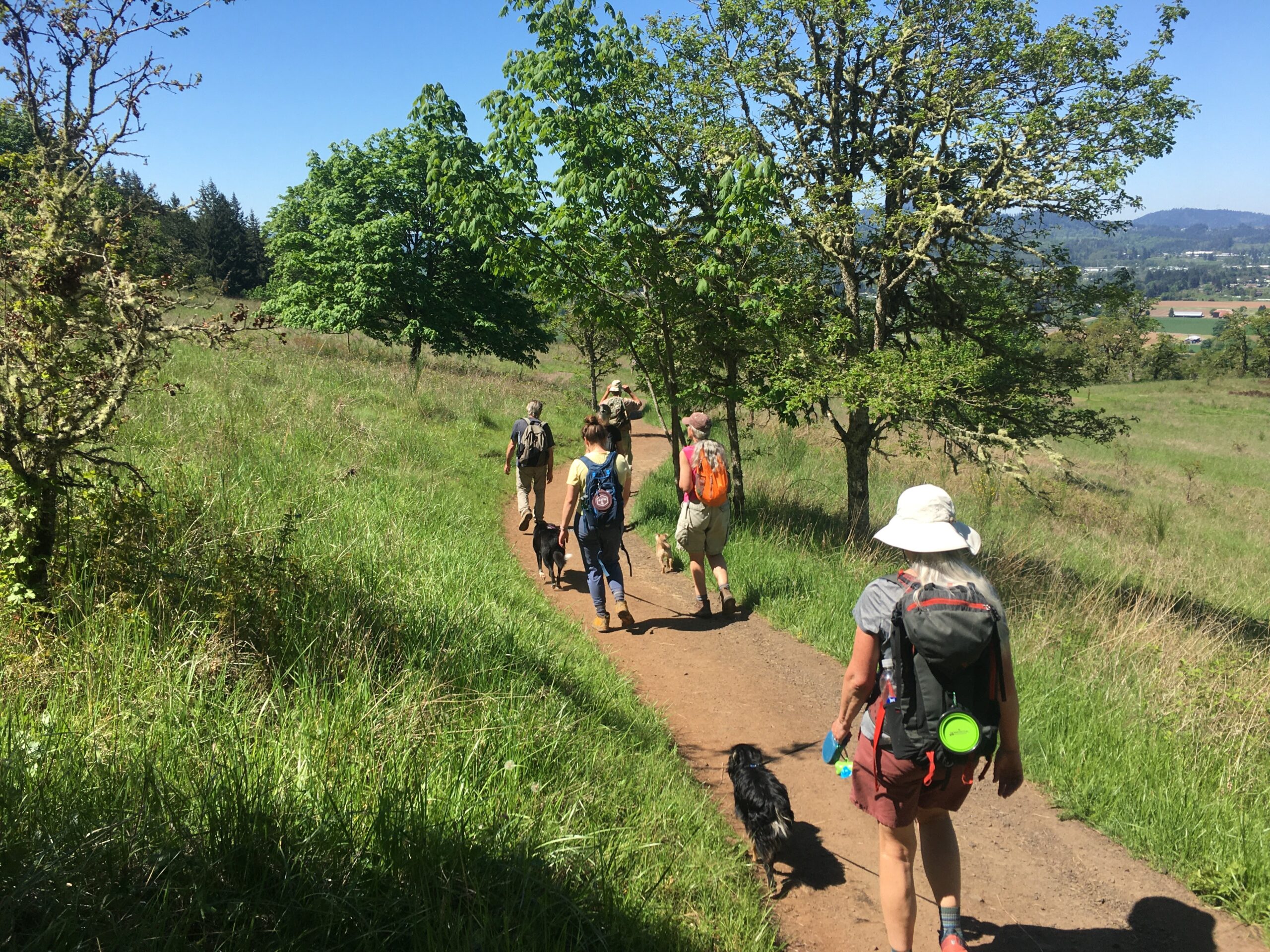
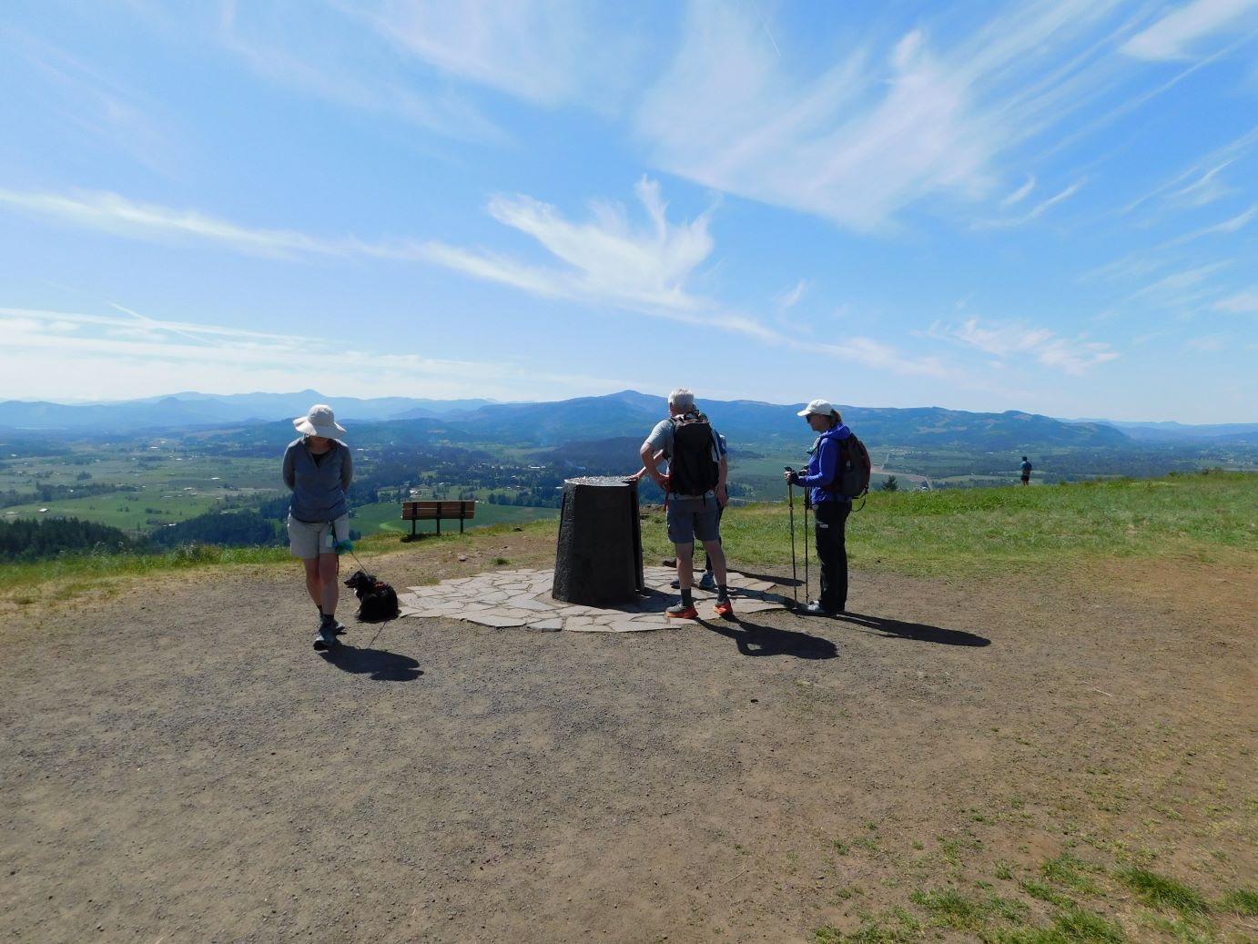
Hike Coordinator: Missy Kroeker

Narration by Missy Kroeker

After such a long, wet winter, spring was here and a handful of eager hikers gathered in the courthouse parking lot to travel to Eugene and the Howard Buford Recreation Area. Also known as Mt. Pisgah for the “mountain” in the park. At the trailhead we met up with Bekah, her dog Bailey and my husband, son and granddaughter. I hadn’t hiked much this winter due to a variety of reasons and it felt good to be on the trail. Spring in Oregon is such a beautiful time of year. Everything is so green! The Mt. Pisgah trail did not disappoint.

I had led this same hike last year. We, again, started at the Southeastern trailhead and made a 7-ish mile loop through the park. It was a warm, clear day. Camas lilies and wild iris lined the approach to the summit. Is Mt. Pisgah getting steeper or am I getting older? I know it’s the later. As always, the views are inspiring. The snow covered Three Sisters to the north, Diamond Peak to the east and the lush farmland near the Williamette River to the south and west. We gathered for our group photos at the summit and said goodbye to my son and granddaughter, who needed to return home. The remainder of us continued on to Swing Hill for lunch. After lunch and some rest, we continued our loop back to the Southeastern trailhead.

It was an enjoyable warm Spring Day hiking with old and new friends. Even though Mt Pisgah is relatively close to home it felt like we got out away a bit. Spring is the time for hope. Hope for new things to come and hope of another great hiking season.

Pictures below by Missy Kroeker

Mount Pisgah – March 5, 2022

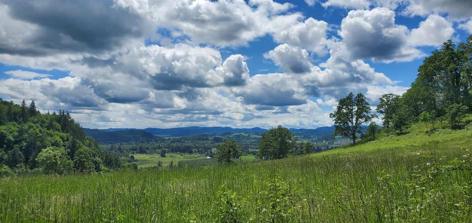
Hike coordinator: Missy Kroeker

Narration by Missy Kroeker

Mt. Pisgah… Mt. Pisgah? It’s kind of a weird name. Upon investigation, the word literally means, “summit”. That’s just what we did, summit a 1,500 foot mount. Mt. Pisgah, by the way, is located in the Howard Buford recreation area just outside of Eugene.

As is our habit, a group of old and new hikers met at the courthouse parking lot ready for adventure. As the hike leader, I provided a map complete with digital map options and written driving directions to the trailhead. For this hike we were to start at the southeast trailhead off of Ridgeway Rd. near Pleasant Hill. It was up to everyone to get there by themselves, as it seemed pretty simple. However, Kyle and George’s phone wasn’t working quite right, so they took a 30-mile detour! Not really knowing what was going on, and not wanting to wait too long for them, the main group started off. What would Richard or Lane have done? Michael stayed behind to wait for them until he reached them by phone. It was agreed we would meet at the summit of Mt. Pisgah.

On this brisk, clear spring day, we headed off using trail # 2 all the way to the summit. This section of the hike was the hardest, as we were summiting a mount after all! We were not disappointed with our efforts, as even with some mid- level clouds, the views were magnificent! We took photos, grabbed some water and a snack. However, still no Kyle or George. We decided to press on. What would Richard or Lane have done? Neither one of them are here!

Downhill on to trail #4. A long downhill through lush vegetation and tall trees on a well maintained wide trail. This trail loops around to the northwest side of the recreation area, where it intersects with trail #3. We took this trail to Swing Hill, and fjust as the name suggests, there is a swing in a giant tree. Shannon took advantage of this swing. The rest of us took advantage of the bench situated under the tree, or used branches as seats on the ground to enjoy our lunch while taking in the westerly views.

Michael was able to reach George by phone from here. They were just at the summit of Mt. Pisgah and it was agreed they would just “do their own thing” and not try to catch up with the rest of us.

After lunch we headed out on trail #3 all the way back, practically to the trailhead. This trail is an easy/moderate traverse across the western slope of Mt. Pisgah. This section was a bit muddy and slippery since it had been raining a few days prior to our hike. The trail wound its way around to the south side of the hill affording us beautiful views of the farms below. A pleasant little creek crossing greeted us a short distance before it connected back to trail #2, which was the trail we started out on.

This whole route clocked in at about 7.5 miles. All in all, it was a terrific day of hiking with old and new friends.

“What do you have to do to lead a hike?”, I had asked Lane and Richard. “Just don’t lose anybody”, they said.

“Oh that’s easy enough”, I say to myself. Not so! Kyle and George had trouble finding the trailhead, initially. Thanks go out to them for being good sports about it all. I think they enjoyed the day of hiking despite, being “lost”.

Pictures below by Missy Kroeker

Scroll Up