Hike Coordinator: Diane Rannow
Narration by Lane Harris
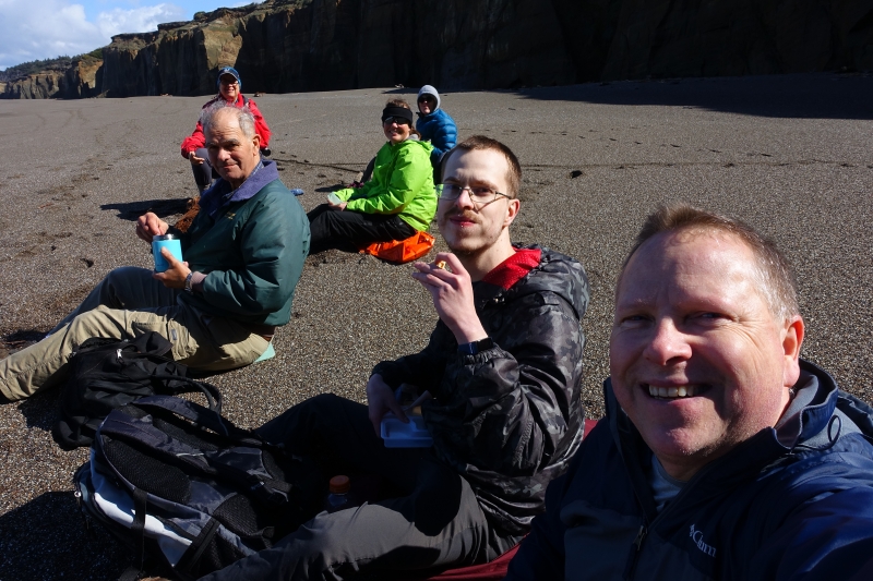
On a cool but pleasant day, Diane led a group of us from Floras Lake down the beach to a cliffside waterfall. Diane had already done the calculations to guarantee a low tide for this hike, thus ensuring that we had enough sand to walk on. The last thing you want is to have an encroaching ocean ruin your beach hiking plans! With Diane in the lead, the rest of us followed. Myself, Colby, Cleve, Robin and Keri were eager to get this hike started!
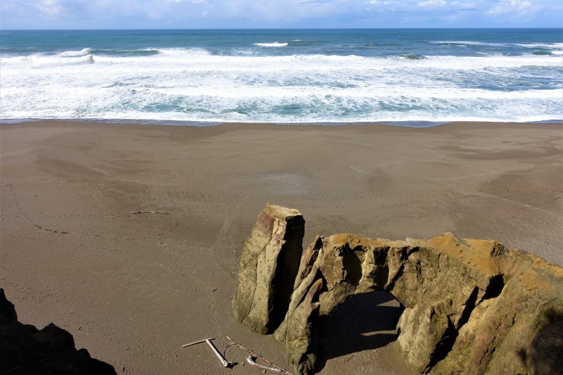
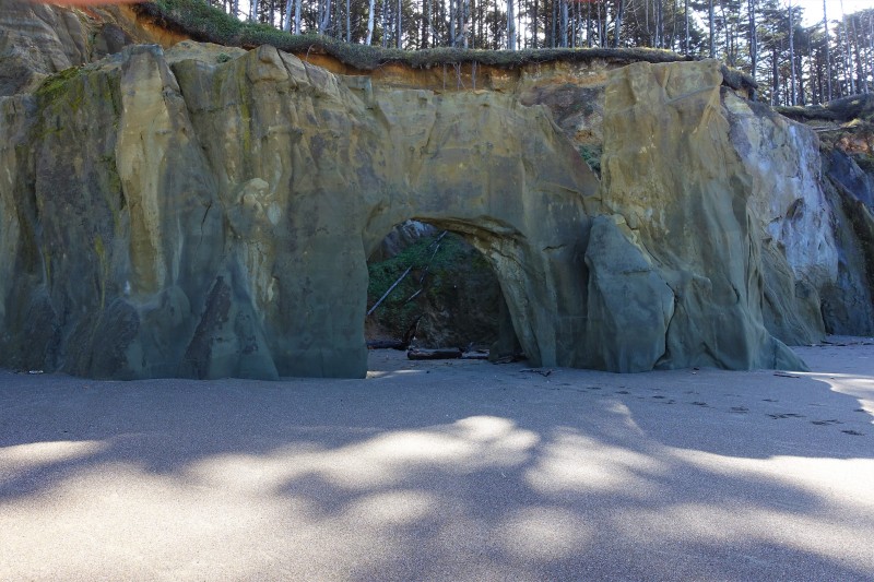
The southerly walk from Floras Lake is an interesting stretch of beach, as it passes by some very fascinating rock and cliff formations. Erosion has done an outstanding job of carving out mesmerizing walls, leaving large crevices, caves, and even archways for us hikers too ooh and ahh over. You really can’t help but to let your attention be taken away from the ocean to look at this marvelous rocky shoreline.
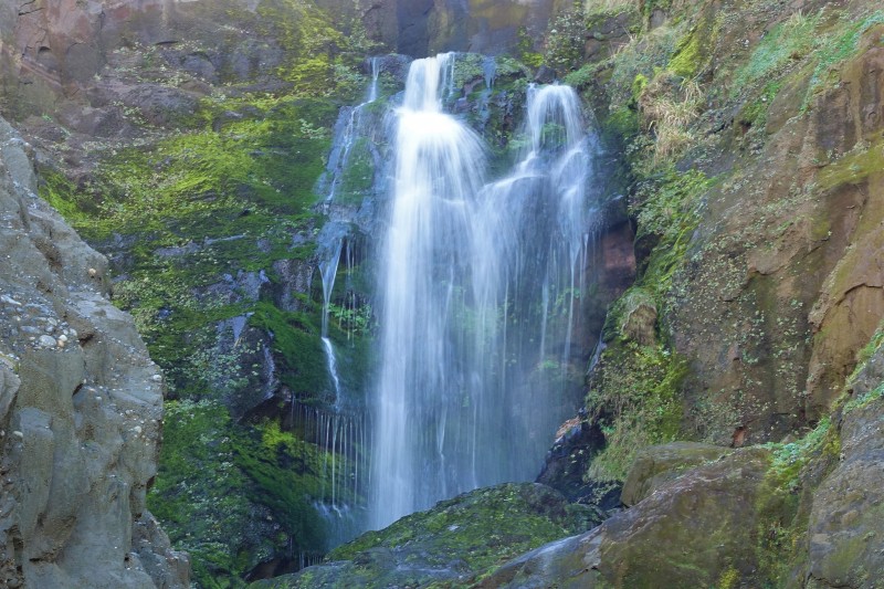
After reaching the terminus of the beach and taking some cool photos of the waterfall spilling over the side of the hill, we plopped down on the beach and had lunch. It was here where we contemplated our next move. Diane had already decided that a 5-mile round-trip hike for her was sufficient, and anyone who wanted to head back with her was free to do so. The other option was to be adventurous and continue on to Blacklock Point, with yours truly taking the lead. Apparently, everyone was feeling bold and exploratory and opted to continue on with our journey to Blacklock Point.
Since I was the only one who had been there before, and the only one with a GPS and a printed map, I assumed the role of hike leader for part II of this hike. I was up front with everyone by claiming yes, I had been to Blacklock Point before, but not from the direction from which we were approaching it from. But fear not, for there is trail nearby, according to my map!
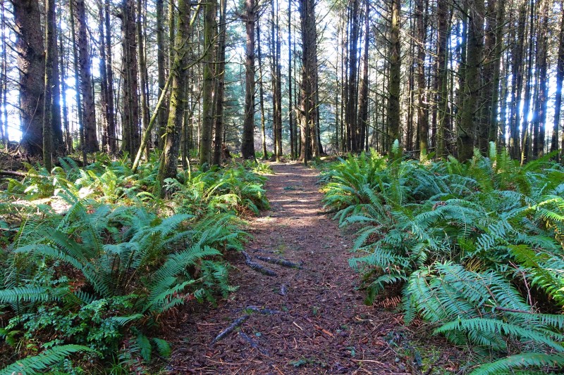
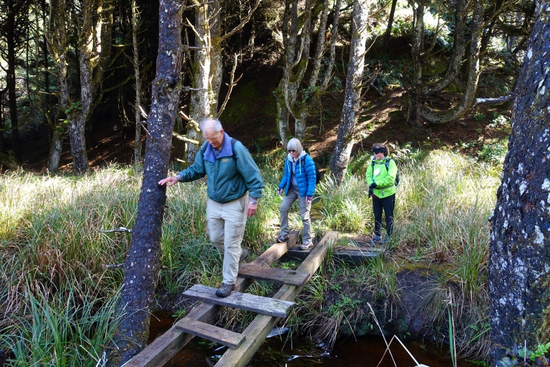
We found the trail and headed south toward our destination. I do have to say that even with a map and GPS, trying to navigate amongst various side trails made for an interesting hike! My plan was just to stay as close as possible to the coastline until we got to familiar territory. With only one “where are we?” moment, we were mostly on course for the duration of the hike.
The plan of staying as close as possible to the coastline eventually paid off when the trail spit us out onto an incredible viewpoint just north of Blacklock Point proper. I was rather inspired about how close we were to our destination; it seemed as if you could almost throw a rock across the chasm and hit Blacklock Point (if you could a rock a half mile). At this point, I figured we would just cut back inland a bit, walk south and be there in no time flat!
It was when we headed back inland that we realized our simple plan was not going to happen, as there was a lack of trail in this thick coastal forest. We were forced to reconnect with the real trail that angles inland for about a mile before hitting the junction that would lead us back out to Blacklock Point, which was another mile. Sigh…
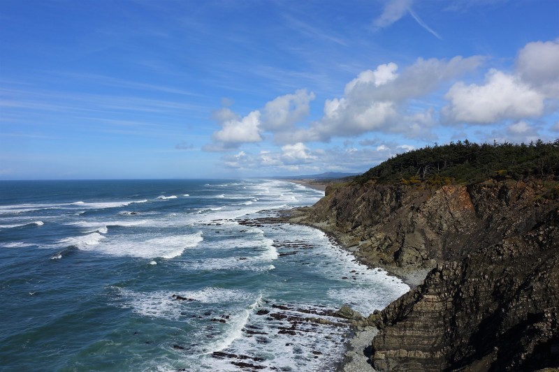
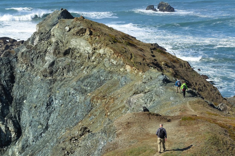
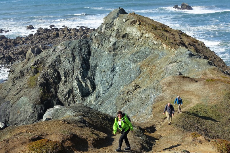
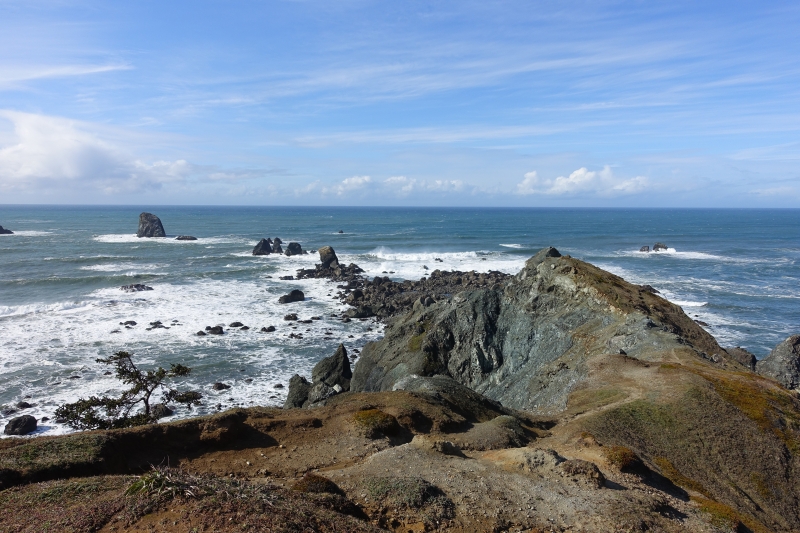
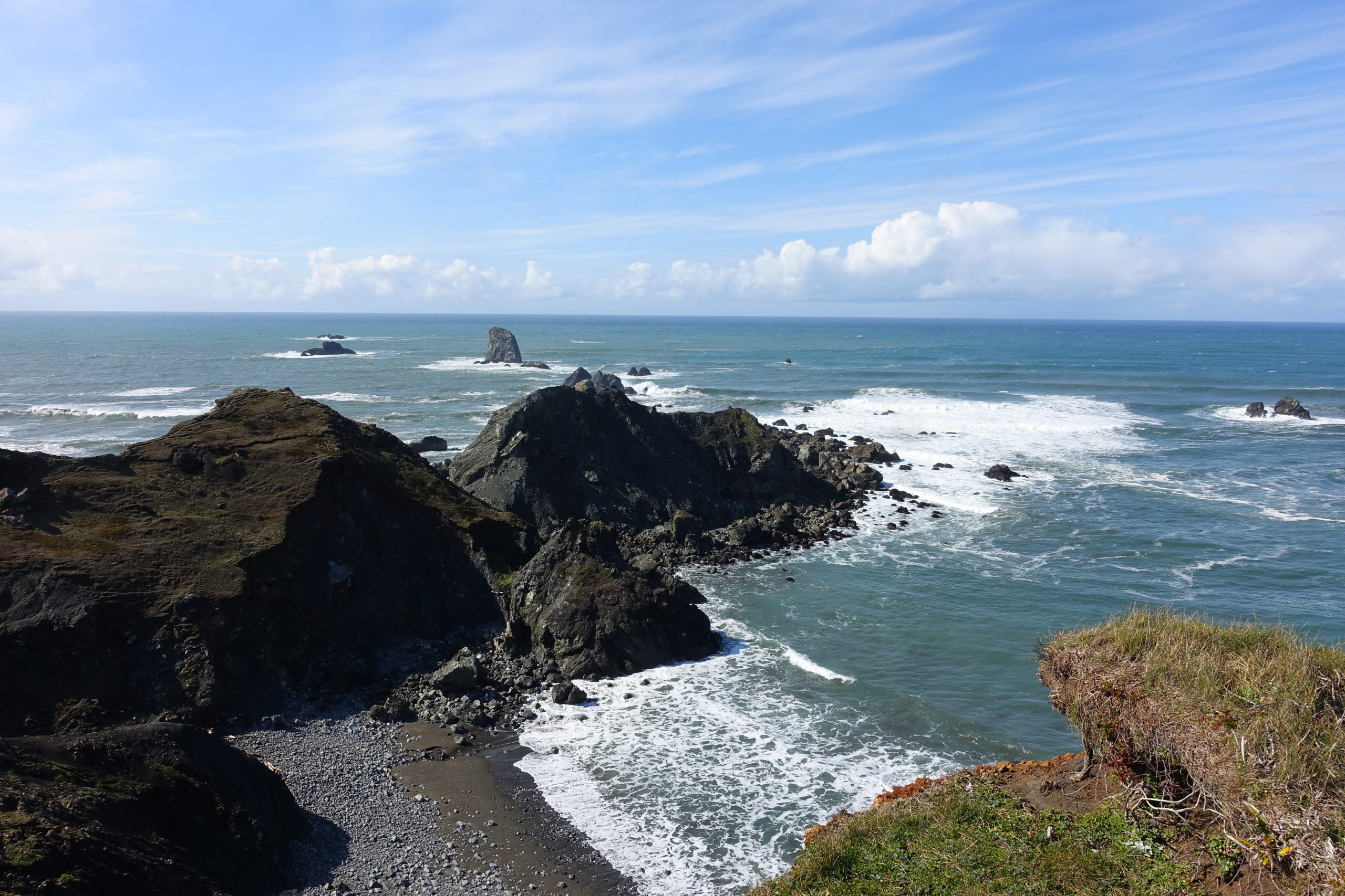
The trail that emerges from the forest and rounds around the south side of Blacklock Point produces a sense of anticipation to those who have never been here before. You just know that there must be something amazing right around the corner. And Blacklock Point does not disappoint with its amazing rocky cliffs and views. The beauty of this place is no secret, as we ran into quite a few other hikers who had trekked out several miles to enjoy this special piece of the Oregon coast.
One of the first things noticed are all the jagged rocks that are peppered out beyond the mainland. The larger ones appear to be lined up in a row, hinting to the fact that at some point eons ago the land had extended at least that far out. As erosion occurred, these stalwart volcanic rocks have refused to be washed away by the ocean, thus providing us humans with a satisfying visual feast.
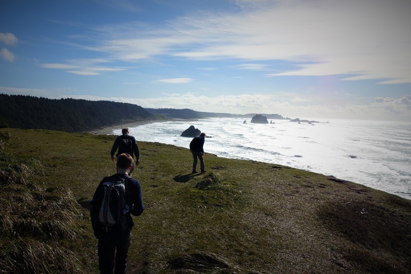
In addition to the rugged coastline, newcomers are drawn to a thin route that heads out even further along the point, a somewhat precarious path for the daring. The first part of the trail is rather flat and easy, until hikers reach an area where the slim trail ekes its way along a nearly 45-degree slope. With the exception of myself and Colby, the rest of the group bravely ventured out to the tip of the point. I’m happy to report they all returned safely.
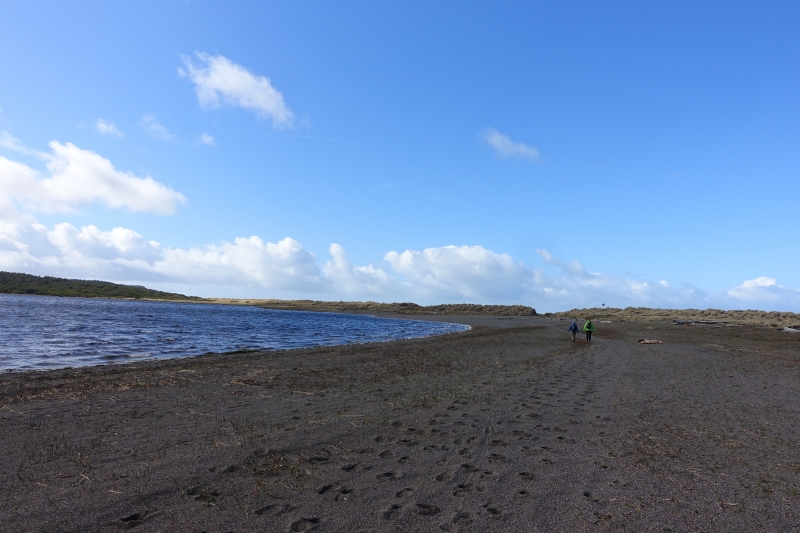
After a final glance at the ocean, we headed back from whence we came and headed back inland to get on the trail leading back to Floras Lake. As I am inclined to do, I took a slightly different route back, exiting the forest onto the beach just south of Floras Lake. It was here where the first rain drops of the day were felt. It appeared as if the sky might open up, so we all stopped to throw our rain jackets on. We had just strapped on our backpacks and started walking up the beach when the rain gods had apparently decided that their little rain prank was over. After only a few minutes of wetness, the rain was gone. Ok, so pack off, and rain jacket off. Stuff rain jacket back into pack. Put pack back on. Continue hiking. I’m sure the rain gods had a good laugh at our expense.
We arrived back at the trailhead after adding 10 miles to our hiking boots. This was a very worthy hike, and everyone agreed the highlight was Blacklock Point, but I have to give credit to Diane for organizing the hike. The walk down the beach is worth doing just by itself. Plus, if we had not hiked down the beach, we would not have had the adventure we had. I’m already thinking about how to do this hike again, minus the “where are we” moments…
More pictures on Lane Harris’ Flickr page
Pictures and video below by Lane Harris