Hike Coordinator: Lane Harris
Narration by lane Harris
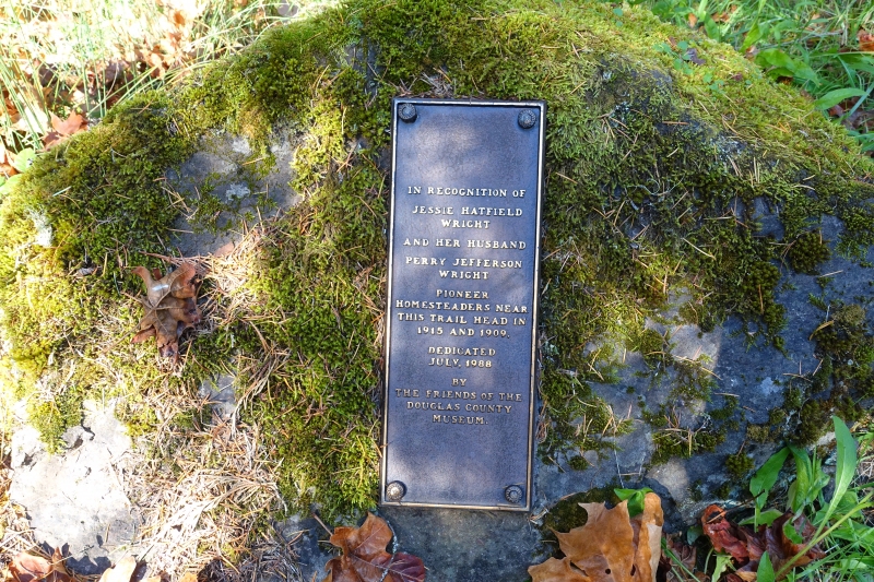
The Jessie Wright section is named after Jessie Wright, who with her husband Perry, built a homestead on nearby Illahee Flats in 1915. They must’ve been hardy people, to reside in a place that dictated that you live a life of day-to-day survival. And to think that we now traipse around this area for mere recreation. And it’s a given that Jessie and Perry Wright would’ve killed to own a pair of Gore-Tex boots!
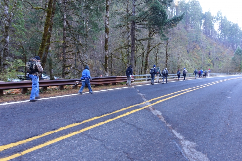
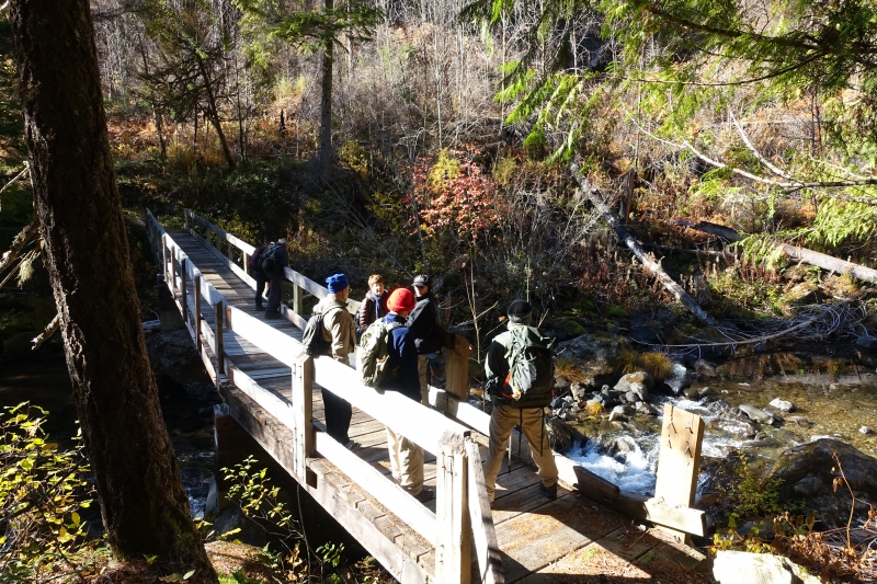
It was 36 degrees at the trailhead when 13 of us hikers headed out on this portion of the NUT (North Umpqua Trail). Ahh, but the sky was blue and the sun was actually shining. Ok, so it wouldn’t keep us warm the whole day, but the thought of knowing that it was there somehow warmed the soul.
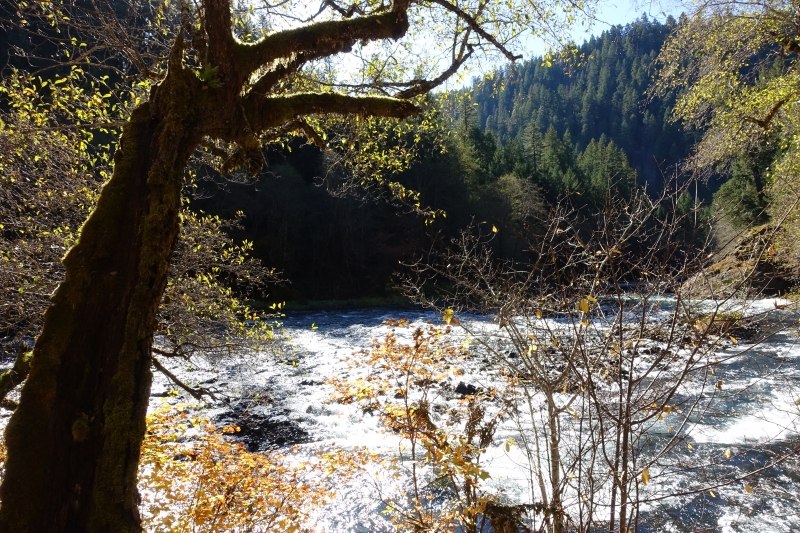
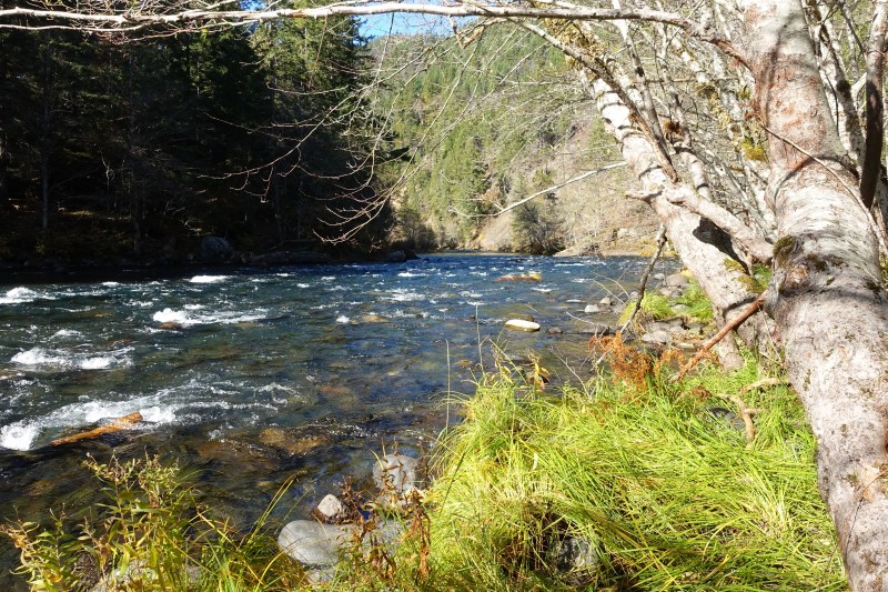
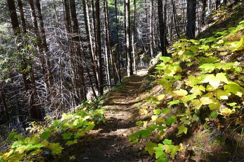
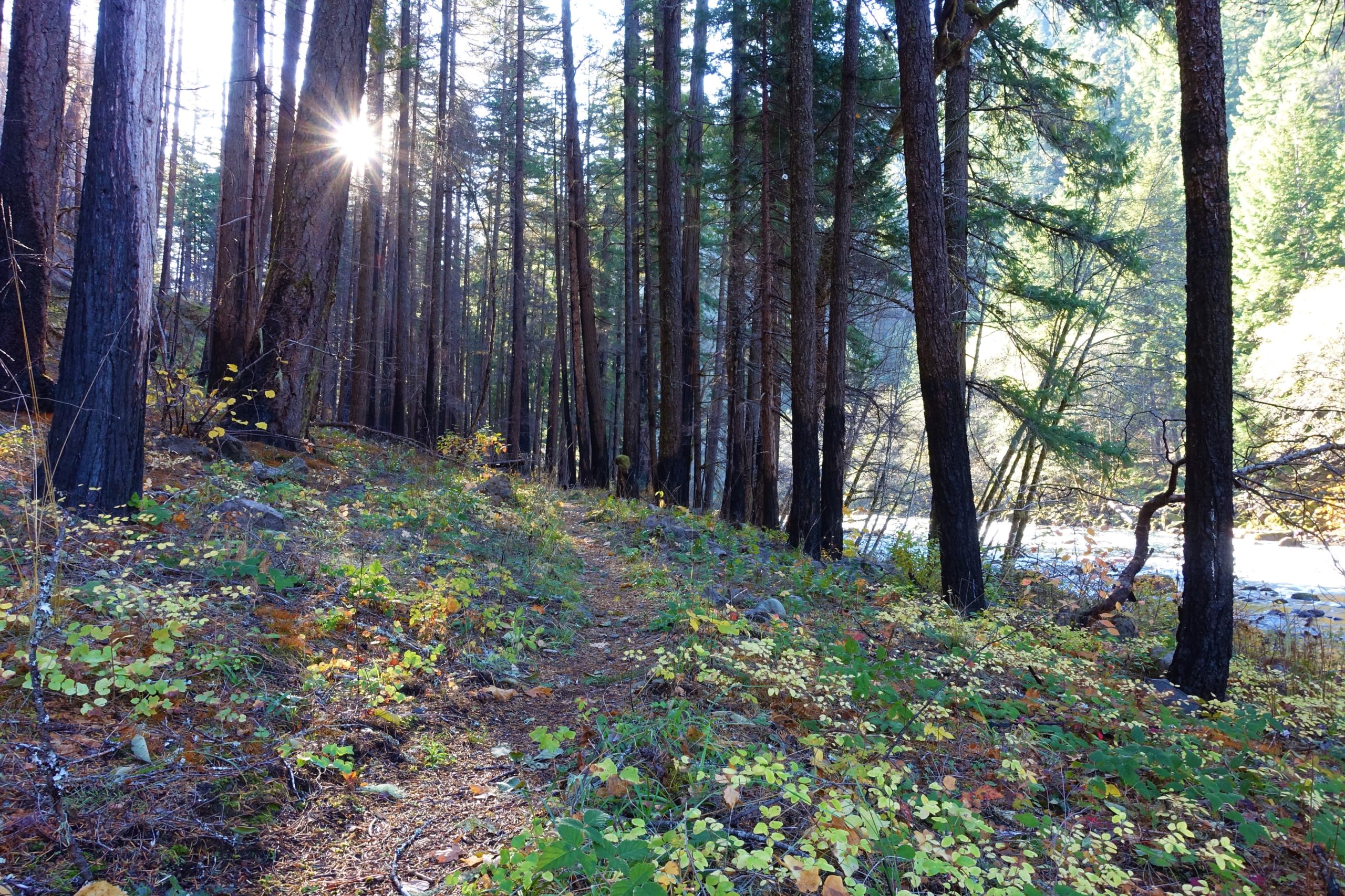
This section of the NUT is where the trail crosses the river and stays on the north side of the highway and river. Theoretically, this means we would be on south-facing slopes, meaning we should see more sun as opposed to being on north-facing slopes. In theory. In reality, we probably caught the sun’s direct rays about 10% of the hike. Oh well, we’ll take it!
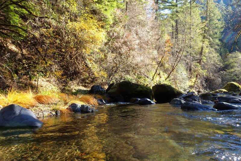
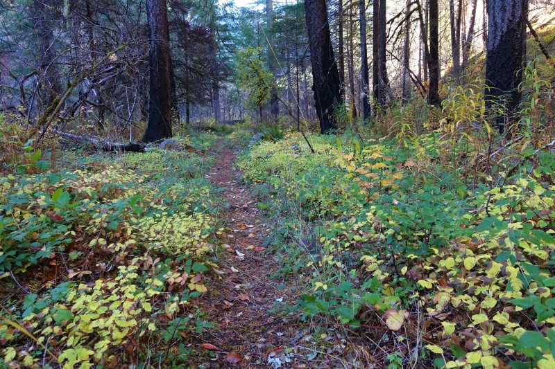
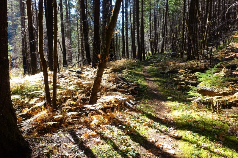
The trail started out fairly level, but soon offered up a few gentle climbs and one steep switchback going downhill. This was gonna be fun to come back up! Eventually, the trail made its way back towards the river, and was absolutely level in some places as we paralleled the North Umpqua River. We walked through the burn zone that occurred several years back, noticing that the forest was recovering quite nicely. However, that same fire totally destroyed a bridge that this hiking club had actually paid for as a way to cross Eagle Creek. Hikers must once again hope the creek isn’t flowing too high as they encounter this part of the trail. Today, all it took was a long step across.
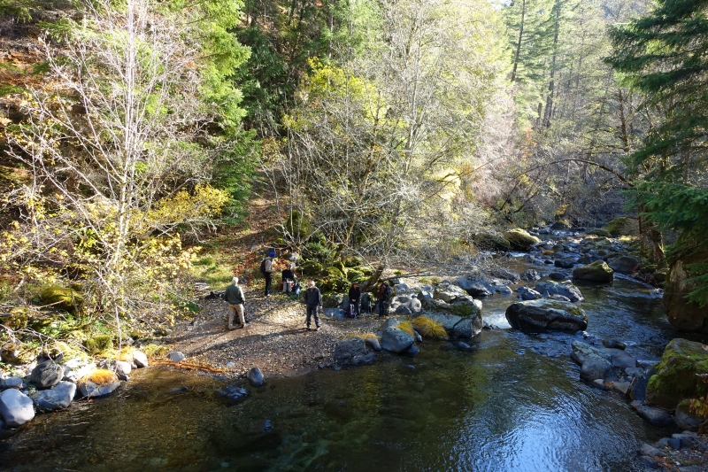
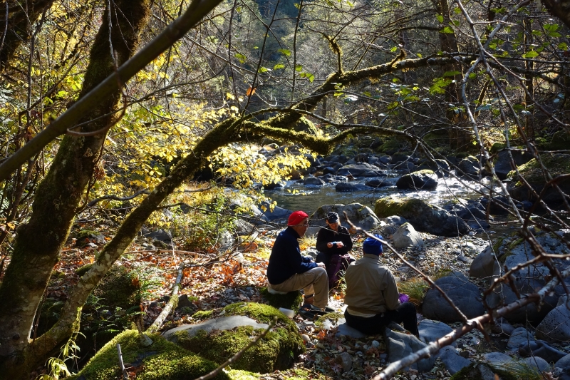
Upon reaching Boulder Creek, we took a long lunch break on a sandy area near the creek. As we jockeyed for positions in the few sunny spots, we discussed about turning around here or going forward. All agreed that this would be a good turn around spot. This section of the trail continues on for about another mile and a half to Soda Springs Dam, but that part of the trail is basically along an old road and is nothing to write home about.
On the return leg, the air was actually heating up, by autumn standards. Most everyone shed one layer and enjoyed the leisurely hike back. Well, except for that steep switchback, this time going uphill! But overall, it was a very satisfying hike on a fantastic fall day.
Read about this hike on Richard O’Neill’s Blog
More picture on Lane Harris’ Flickr page and Richard O’Neill’s Flickr page
Pictures below by Lane Harris